Bleikiwald
Bleikiwald is in Canton of Bern, Switzerland and has an elevation of 945 metres. Bleikiwald is situated nearby to Alpenwildpark Interlaken-Harder, as well as near the motorhome stopover TCS Camping Sackgut.| Tap on a place to explore it |
Places of Interest Nearby
Highlights include Interlaken Ost Railway Station and Interlaken West railway station.
Interlaken Ost Railway Station
Railway station

Photo: Shansov.net, CC BY 3.0.
Interlaken Ost or Interlaken East is a railway station in the resort town of Interlaken in the Swiss canton of Bern. The station was previously known as Interlaken Zollhaus. Interlaken Ost Railway Station is situated 780 metres southeast of Bleikiwald.
Interlaken West railway station
Railway station

Photo: Belteshassar, CC BY-SA 3.0.
Interlaken West is a railway station in the resort town of Interlaken, in the Swiss canton of Bern. It is on the Thunersee line of the BLS AG, and is one of two stations in the town, the other being Interlaken Ost. Interlaken West railway station is situated 2 km southwest of Bleikiwald.
Roman catholic church of the Holy Spirit
Church
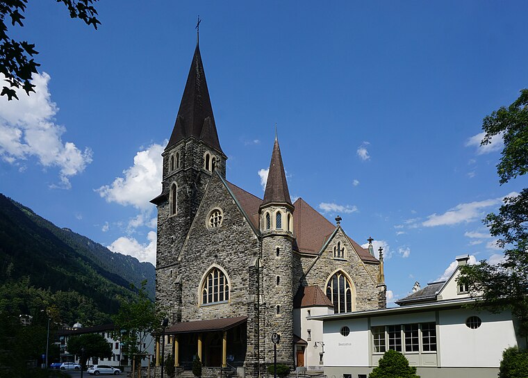
Photo: Ginkgo2g, CC BY-SA 4.0.
Roman catholic church of the Holy Spirit is situated 1 km south of Bleikiwald.
Places in the Area
Nearby places include Harderkulm and Interlaken.
Harderkulm
Locality

Photo: Pemm, Public domain.
The Harderkulm is a funicular station at 1,322 metres in the Berner Oberland region of Switzerland, overlooking the towns of Interlaken and Unterseen. It is located at the western end of the Harder, which in itself is the most western, forested ridge of the about 30 kilometres long, prominent mountain range dominating the north shore of the Lake of Brienz.
Interlaken
 Interlaken is a small city in the Bernese Highlands region of central Switzerland. Located between two alpine lakes, Interlaken is a popular base camp for outdoor sports and travel in the surrounding Bernese Oberland Alps.
Unterseen
Village

Photo: Wikimedia, CC BY-SA 3.0.
Unterseen is a historic town and a municipality in the Interlaken-Oberhasli administrative district in the canton of Bern in Switzerland. Unterseen literally means Lower Lake, which is correct, since Unterseen is located on the flat area on the eastern shore of Lake Thun between the two creek Lombach below the Chienberg to the north and the Aare to the south, which both flow into Lake Thun.
Bleikiwald
- Type: Sign
- Categories: information and tourism
- Location: Canton of Bern, Switzerland, Central Europe, Europe
- View on OpenStreetMap
Latitude
46.6969° or 46° 41′ 49″ northLongitude
7.86509° or 7° 51′ 54″ eastElevation
945 metres (3,100 feet)Open location code
8FR9MVW8+Q2OpenStreetMap ID
node 10793586903OpenStreetMap feature
tourism=information
This page is based on OpenStreetMap, Wikidata, and Wikimedia Commons.
We’d love your help improving our open data sources. Thank you for contributing.
Satellite Map
Discover Bleikiwald from above in high-definition satellite imagery.
Notable Places Nearby
Highlights include Bleikiwald and Alpenwildpark Interlaken-Harder.
Nearby Places
Explore places such as Bleiki and TCS Camping Sackgut.
Switzerland: Must-Visit Destinations
Delve into Zurich, Berne, Geneva, and Basel.
Curious Places to Discover
Uncover intriguing places from every corner of the globe.
About Mapcarta. Data © OpenStreetMap contributors and available under the Open Database License". Text is available under the CC BY-SA 4.0 license, except for photos, directions, and the map. Photo: Simonizer, CC BY-SA 2.0 de.