Genthiner
Genthiner is a shop in Usingen, Hochtaunuskreis, Hesse. Genthiner is situated nearby to the government office Jugendhilfe in Strafsachen, as well as near KFZ Zulassungsstelle.| Tap on a place to explore it |
Places of Interest Nearby
Highlights include Hugenottenkirche and Baitul Huda Mosque.
Hugenottenkirche
Government building
 Hugenottenkirche is a government building, which is situated 520 metres southeast of Genthiner.
Baitul Huda Mosque
Mosque
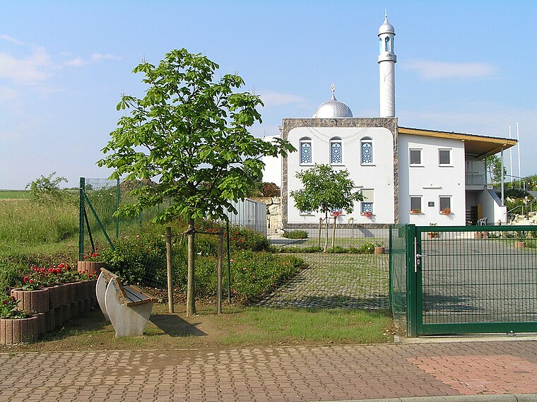
Photo: Wikimedia, Public domain.
The Baitul Huda is a Ahmadiyya mosque, located in Usingen, Germany. The mosque was inaugurated on September 7, 2004, by Mirza Masroor Ahmad. Its two prayer rooms are 77 square metres each; and the community in Usingen has 160 members. Baitul Huda Mosque is situated 1 km southwest of Genthiner.
Rathaus Usingen
Town hall

Photo: Reinhardhauke, CC BY-SA 3.0.
Rathaus Usingen is a town hall, which is situated 1 km southeast of Genthiner.
Places in the Area
Nearby places include Eschbach and Michelbach.
Eschbach
Village

Photo: Osingar, CC BY-SA 4.0.
Eschbach is a borough of Usingen in the Hochtaunuskreis in Hessen. The once almost entirely agriculturally based village at the northern edge of the Usinger Becken first appeared in 1280 in the County Cleeberg under the name of Ketteneschbach.
Michelbach
Village

Photo: Karsten11, Public domain.
Michelbach is a village, which is situated 4 km north of Genthiner.
Neu-Anspach
Town

Photo: Dontworry, CC BY-SA 3.0.
Neu-Anspach is a town in the Hochtaunuskreis in Hesse, Germany. Neu-Anspach is situated 5 km south of Genthiner.
Genthiner
- Type: Shop
- Location: Usingen, Hochtaunuskreis, South Hesse, Hesse, Germany, Central Europe, Europe
- View on OpenStreetMap
Latitude
50.33846° or 50° 20′ 19″ northLongitude
8.52748° or 8° 31′ 39″ eastOpen location code
9F2C8GQG+9XOpenStreetMap ID
node 10793994868OpenStreetMap feature
shop=number_plate
This page is based on OpenStreetMap, Wikidata, and Wikimedia Commons.
We’d love your help improving our open data sources. Thank you for contributing.
Satellite Map
Discover Genthiner from above in high-definition satellite imagery.
Notable Places Nearby
Highlights include Jugendhilfe in Strafsachen and KFZ Zulassungsstelle.
Nearby Places
Explore places such as Physio Team and Götte.
South Hesse: Must-Visit Destinations
Delve into Darmstadt, Bensheim, Lorsch, and Heppenheim.
Curious Shops to Discover
Uncover intriguing shops from every corner of the globe.
About Mapcarta. Data © OpenStreetMap contributors and available under the Open Database License". Text is available under the CC BY-SA 4.0 license, except for photos, directions, and the map. Photo: Mylius, GFDL.