Collado de la Mina de la Pastora
Collado de la Mina de la Pastora is a mountain saddle in Almería, Almería, Andalusia and has an elevation of 451 metres. Collado de la Mina de la Pastora is situated nearby to the locality Cerro Gallado, as well as near Cuesta del Fraile.| Tap on a place to explore it |
Places of Interest
Highlights include Cueva del Gato and Mina de Talco-Rambla de Belén.


Places in the Area
Nearby places include Huércal de Almería and Viator.
Huércal de Almería
Village

Photo: Rubén.huercaldealmeria, CC BY-SA 4.0.
Huércal de Almería is a municipality of Almería province, in the autonomous community of Andalusia, Spain.
Viator
Village
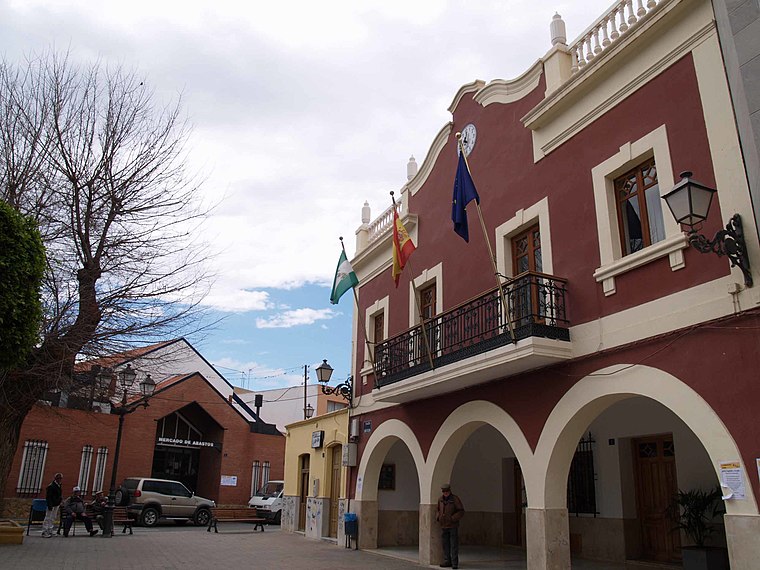
Photo: Wikimedia, CC BY-SA 4.0.
Viator is a municipality of Almería province, in the autonomous community of Andalusia, Spain. José Brocca lived here.
Benahadux
Village

Photo: Schumi4ever, CC BY-SA 3.0.
Benahadux is a municipality of Almería province, in the autonomous community of Andalusia, Spain.
Collado de la Mina de la Pastora
- Type: Mountain saddle with an elevation of 451 metres
- Category: landform
- Location: Almería, Almería, Andalusia, Spain, Iberia, Europe
- View on OpenStreetMap
Latitude
36.8738° or 36° 52′ 26″ northLongitude
-2.496° or 2° 29′ 46″ westElevation
451 metres (1,480 feet)Open location code
8C8VVGF3+GJOpenStreetMap ID
node 1081047984OpenStreetMap feature
natural=saddle
This page is based on OpenStreetMap, Wikidata, and Wikimedia Commons.
We’d love your help improving our open data sources. Thank you for contributing.
Satellite Map
Discover Collado de la Mina de la Pastora from above in high-definition satellite imagery.
Localities in the Area
Explore places such as Cerro Gallado and Cuesta del Fraile.
Notable Places Nearby
Highlights include Cerro del Fraile and Collado del Fraile.
Almería: Must-Visit Destinations
Delve into Sierra Nevada, Roquetas de Mar, Adra, and Culturally significant landscapes in Almería.
Curious Mountain Saddles to Discover
Uncover intriguing mountain saddles from every corner of the globe.
About Mapcarta. Data © OpenStreetMap contributors and available under the Open Database License". Text is available under the CC BY-SA 4.0 license, except for photos, directions, and the map. Photo: Schumi4ever, CC BY-SA 3.0.