Sweet&Fit
Sweet&Fit is a bakery in Guadalajara, Jalisco. Sweet&Fit is situated nearby to the health club Station 24, as well as near the pitch Paseo San Ignacio Skatepark.| Tap on a place to explore it |
Places of Interest Nearby
Highlights include Matute Remus Bridge and Hotel Riu Plaza Guadalajara.
Matute Remus Bridge
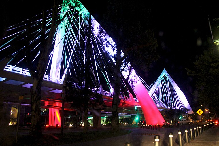 The Matute Remus Bridge is a cable-stayed bridge located in the state of Jalisco, Mexico. This work is part of a system of bridges that are located on the Lázaro Cárdenas road, at the junction with López Mateos avenue, one of the busiest in the city and that also crosses the 4 central municipalities of the Guadalajara metropolitan area. Matute Remus Bridge is situated 1¼ km east of Sweet&Fit.
Hotel Riu Plaza Guadalajara
Hotel

Photo: Pollo Inc., CC BY-SA 3.0.
Hotel Riu Plaza Guadalajara is a skyscraper hotel located in the city of Guadalajara, Jalisco, Mexico. At 204-metre tall, it is the city and metropolitan area's tallest building and the twelfth highest in Mexico to date. Hotel Riu Plaza Guadalajara is situated 1¼ km east of Sweet&Fit.
Statue of Minerva, Guadalajara
Monument

Photo: ProtoplasmaKid, CC BY-SA 4.0.
A statue of Minerva, the Roman goddess of wisdom and strategic warfare, stands in a roundabout fountain in Guadalajara, Mexico. The bronze sculpture rests on a large pedestal inscribed with the names of 18 notable citizens of the city. Statue of Minerva, Guadalajara is situated 2 km east of Sweet&Fit.
Sweet&Fit
- Type: Bakery
- Categories: shop and food
- Location: Guadalajara, Jalisco, Pacific Coast, Mexico, North America
- View on OpenStreetMap
Latitude
20.66887° or 20° 40′ 8″ northLongitude
-103.40489° or 103° 24′ 18″ westOpen location code
75GRMH9W+G2OpenStreetMap ID
node 10811494007OpenStreetMap feature
shop=bakery
This page is based on OpenStreetMap, Wikidata, and Wikimedia Commons.
We’d love your help improving our open data sources. Thank you for contributing.
Satellite Map
Discover Sweet&Fit from above in high-definition satellite imagery.
Places with the Same Name
Discover other places named “Sweet&Fit”.
Notable Places Nearby
Highlights include Station 24 and Paseo San Ignacio Skatepark.
Nearby Places
Explore places such as La Borra del Café and Instituto Anahuacalli;Instituto Ana�Huacalli A C.
Jalisco: Must-Visit Destinations
Delve into Puerto Vallarta, Tequila, Tepatitlan, and Lagos de Moreno.
Curious Bakeries to Discover
Uncover intriguing bakeries from every corner of the globe.
About Mapcarta. Data © OpenStreetMap contributors and available under the Open Database License". Text is available under the CC BY-SA 4.0 license, except for photos, directions, and the map. Photo: Wikimedia, CC0.