Österreichischer Integrations Fonds
Österreichischer Integrations Fonds is a government office in Landstraße, Vienna which is located on Landstraßer Hauptstraße. Österreichischer Integrations Fonds is situated nearby to the church Kirche der Siebenten-Tags Adventisten, as well as near Tanzschule Kraml.| Tap on a place to explore it |
- Opening hours:
Monday—Thursday: 7:30 AM—6:30 PM
Friday: 7:30 AM—4:30 PM - Type: Government office
- Address: Landstraßer Hauptstraße 26
Places of Interest Nearby
Highlights include University of Music and Performing Arts Vienna and Hundertwasserhaus.
University of Music and Performing Arts Vienna
University

Photo: Wikimedia, Public domain.
The University of Music and Performing Arts Vienna is an Austrian university established in 1817 located in Vienna. With a student body of over three thousand, it is the largest institution of its kind in Austria, and one of the largest in the world. University of Music and Performing Arts Vienna is situated 300 metres southwest of Österreichischer Integrations Fonds.
Hundertwasserhaus

Photo: Bwag, CC BY-SA 4.0.
The Hundertwasserhaus is an apartment house in Vienna, Austria, completed in 1985, after the idea and concept of Austrian artist Friedensreich Hundertwasser. Hundertwasserhaus is situated 550 metres northeast of Österreichischer Integrations Fonds.
Museum of Applied Arts, Vienna
Museum
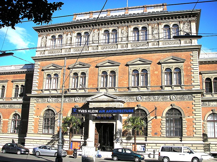
Photo: Gryffindor, CC BY 2.5.
The MAK – Museum of Applied Arts is an arts and crafts museum located at Stubenring 5 in Vienna's 1st district Innere Stadt. Besides its traditional orientation towards arts and crafts and design, the museum especially focuses on architecture and contemporary art. Museum of Applied Arts, Vienna is situated 630 metres northwest of Österreichischer Integrations Fonds.
Places in the Area
Nearby places include Pratercottage and Erdberg.


Österreichischer Integrations Fonds
- Categories: office and government building
- Location: Landstraße, Vienna, Austria, Central Europe, Europe
- View on OpenStreetMap
Latitude
48.20402° or 48° 12′ 15″ northLongitude
16.38856° or 16° 23′ 19″ eastOpen location code
8FWR693Q+JCOpenStreetMap ID
node 10819966444OpenStreetMap feature
office=government
This page is based on OpenStreetMap, Wikidata, and Wikimedia Commons.
We’d love your help improving our open data sources. Thank you for contributing.
Satellite Map
Discover Österreichischer Integrations Fonds from above in high-definition satellite imagery.
Places with the Same Name
Discover other places named “Österreichischer Integrations Fonds”.
Notable Places Nearby
Highlights include Kirche der Siebenten-Tags Adventisten and Tanzschule Kraml.
Nearby Places
Explore places such as Hofer and Ludwig Van Beethoven.
Vienna: Must-Visit Destinations
Delve into Innere Stadt, Vienna International Airport, Inner East, and Hietzing.
Curious Government Offices to Discover
Uncover intriguing government offices from every corner of the globe.
About Mapcarta. Data © OpenStreetMap contributors and available under the Open Database License". Text is available under the CC BY-SA 4.0 license, except for photos, directions, and the map. Photo: Miguel Mendez, CC BY 2.0.