Cove de l’Angel
Cove de l’Angel is a cave in Ciutadella, Balearic Islands, Balearic Islands. Cove de l’Angel is situated nearby to the cave Cove des Taba, as well as near Coves de Son Salamò.| Tap on a place to explore it |
Places of Interest Nearby
Highlights include Punta Nati Lighthouse and Granja solar de Son Salomó.
Punta Nati Lighthouse
Lighthouse
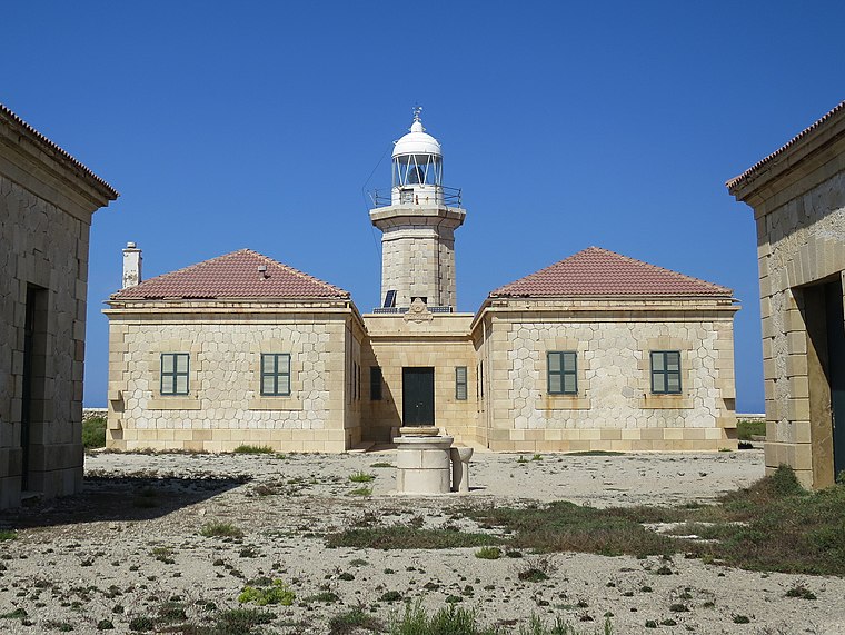
Photo: Ben Salter, CC BY 2.0.
The Punta Nati Lighthouse is an active aid to navigation located on the rocky north western coast of the Spanish island of Menorca. The lighthouse was built following demands from the French authorities to light the northern coast of the island. Punta Nati Lighthouse is situated 2 km northeast of Cove de l’Angel.
Granja solar de Son Salomó
Power station

Photo: MontanNito, CC BY-SA 4.0.
Granja solar de Son Salomó is a power station, which is situated 1½ km southeast of Cove de l’Angel.
Es Castellet des Pop Mosquer
Archaeological site

Photo: Sa monea, CC BY-SA 3.0.
Es Castellet des Pop Mosquer is an archaeological site, which is situated 2 km southwest of Cove de l’Angel.
Cove de l’Angel
- Type: Cave
- Category: landform
- Location: Ciutadella, Balearic Islands, Menorca, Balearic Islands, Spain, Iberia, Europe
- View on OpenStreetMap
Latitude
40.03595° or 40° 2′ 9″ northLongitude
3.81369° or 3° 48′ 49″ eastOpen location code
8FG52RP7+9FOpenStreetMap ID
node 10858753647OpenStreetMap feature
natural=cave_entrance
This page is based on OpenStreetMap, Wikidata, and Wikimedia Commons.
We’d love your help improving our open data sources. Thank you for contributing.
Satellite Map
Discover Cove de l’Angel from above in high-definition satellite imagery.
Notable Places Nearby
Highlights include Cove des Taba and Coves de Son Salamò.
Nearby Places
Explore places such as Faro de Punta Nati and Memorial General Chanzy.
Menorca: Must-Visit Destinations
Delve into Maó, Es Mercadal, Cala Galdana, and Cala en Bosch.
Curious Caves to Discover
Uncover intriguing caves from every corner of the globe.
About Mapcarta. Data © OpenStreetMap contributors and available under the Open Database License". Text is available under the CC BY-SA 4.0 license, except for photos, directions, and the map. Photo: Ben Salter, CC BY 2.0.