Statie Taxi Gavana Piata
Statie Taxi Gavana Piata is a taxicab stand in Pitești, Argeș County which is located on Gavana Piata. Statie Taxi Gavana Piata is situated nearby to the casino Maxbet, as well as near the church Martorii lui Iehova.| Tap on a place to explore it |
Places of Interest Nearby
Highlights include Arges County Museum and Pitești city hall.
Arges County Museum
Museum
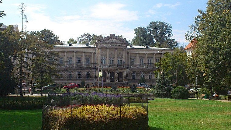
Photo: Stancosty, CC BY-SA 3.0 ro.
The Argeș County Museum is a government institution and visitor attraction based in Pitești, Romania. Formally inaugurated in 1955, it is headquartered in an 1890s palace in the city center. Arges County Museum is situated 3 km southeast of Statie Taxi Gavana Piata.
Pitești city hall
Town hall

Photo: Stancosty, CC BY-SA 3.0 ro.
Pitești city hall is a town hall, which is situated 2½ km southeast of Statie Taxi Gavana Piata.
Stadionul Nicolae Dobrin
Stadium

Photo: Crispas, CC BY-SA 3.0.
Nicolae Dobrin Stadium was a multi-purpose stadium in Piteşti, Romania, named in 2003 after football player Nicolae Dobrin. It was mostly used for football matches as the home ground of FC Argeş Piteşti. Stadionul Nicolae Dobrin is situated 3½ km southeast of Statie Taxi Gavana Piata.
Places in the Area
Nearby places include Bascov and Valea Mare-Podgoria.
Bascov
Village

Photo: David Chifiriuc, CC BY 3.0.
Bascov is a village, which is situated 3½ km northwest of Statie Taxi Gavana Piata.
Valea Mare-Podgoria
Village

Photo: Mihalache Sinziana, CC BY-SA 3.0 ro.
Valea Mare-Podgoria is a village, which is situated 4½ km east of Statie Taxi Gavana Piata.
Glâmbocu
Village

Photo: David Chifiriuc, CC BY 3.0.
Glâmbocu is a village, which is situated 5 km northwest of Statie Taxi Gavana Piata.
Statie Taxi Gavana Piata
- Type: Taxicab stand
- Address: Gavana Piata
- Category: transportation
- Location: Pitești, Argeș County, Romania, Balkans, Europe
- View on OpenStreetMap
Latitude
44.87229° or 44° 52′ 20″ northLongitude
24.84507° or 24° 50′ 42″ eastOpen location code
8GP6VRCW+W2OpenStreetMap ID
node 10860074652OpenStreetMap feature
amenity=taxi
This page is based on OpenStreetMap, Wikidata, and Wikimedia Commons.
We’d love your help improving our open data sources. Thank you for contributing.
Satellite Map
Discover Statie Taxi Gavana Piata from above in high-definition satellite imagery.
Notable Places Nearby
Highlights include Maxbet and Martorii lui Iehova.
Nearby Places
Explore places such as Profi and Superbet.
Romania: Must-Visit Destinations
Delve into Bucharest, Cluj-Napoca, Timișoara, and Iași.
Curious Taxicab Stands to Discover
Uncover intriguing taxicab stands from every corner of the globe.
About Mapcarta. Data © OpenStreetMap contributors and available under the Open Database License". Text is available under the CC BY-SA 4.0 license, except for photos, directions, and the map. Photo: Wikimedia, CC BY-SA 4.0.