Te Roig
Te Roig is a bay in Es Mercadal, Balearic Islands, Balearic Islands.| Tap on a place to explore it |
Places of Interest
Highlights include Torre de Fornells and House of the Boatswain in Fornells.
Torre de Fornells
Scenic viewpoint

Photo: Carles garcia-roca, Public domain.
Torre de Fornells is a scenic viewpoint.
House of the Boatswain in Fornells
Tourism office

Photo: Josefito123, CC BY-SA 4.0.
House of the Boatswain in Fornells is a tourism office.
Sant Antoni Castle
Ruins

Photo: Herodotptlomeu, CC BY-SA 3.0.
The Sant Antoni Castle is a fortress located in the Spanish village of Fornells, in the municipality of Es Mercadal, in Menorca. It was built in the 17th century in the local harbour and due to this building, the town was born.
Places in the Area
Nearby places include Fornells.
Fornells
Village
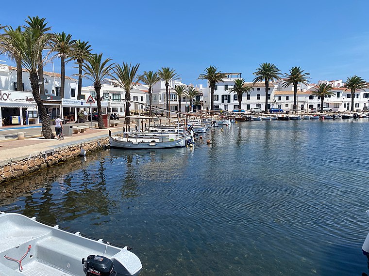
Photo: Lohen11, CC BY-SA 4.0.
Fornells is a village located in a bay in the north of the Balearic island of Menorca, Spain. Fornells is estimated to have a population of about 1000 people which increases in the summer due to tourism.
Te Roig
- Type: Bay
- Category: body of water
- Location: Es Mercadal, Balearic Islands, Menorca, Balearic Islands, Spain, Iberia, Europe
- View on OpenStreetMap
Latitude
40.0485° or 40° 2′ 55″ northLongitude
4.1652° or 4° 9′ 55″ eastOpen location code
8FG625X8+93OpenStreetMap ID
node 10860565597OpenStreetMap feature
natural=bay
This page is based on OpenStreetMap, Wikidata, and Wikimedia Commons.
We’d love your help improving our open data sources. Thank you for contributing.
Satellite Map
Discover Te Roig from above in high-definition satellite imagery.
Localities in the Area
Explore places such as Bassa Verda and Mola de Fornells.
Notable Places Nearby
Highlights include Caló Verd and Macar de Cala Pudenta.
Menorca: Must-Visit Destinations
Delve into Maó, Ciutadella, Cala Galdana, and Cala en Bosch.
Curious Bays to Discover
Uncover intriguing bays from every corner of the globe.
About Mapcarta. Data © OpenStreetMap contributors and available under the Open Database License". Text is available under the CC BY-SA 4.0 license, except for photos, directions, and the map. Photo: Nicolas G. Mertens, CC BY-SA 4.0.