Kids Around Vittel
Kids Around Vittel is a clothing store in Vittel, Arrondissement of Neufchâteau, Grand Est. Kids Around Vittel is situated nearby to Square de l’Alpha, as well as near the post office Bureau de Poste de Vittel.| Tap on a place to explore it |
Places of Interest Nearby
Highlights include Gare de Vittel and Église Saint-Privat de Vittel.
Gare de Vittel
Railway stop
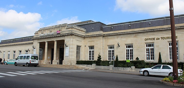
Photo: Christophe.Finot, CC BY-SA 3.0.
Gare de Vittel is a railway stop, which is situated 300 metres northwest of Kids Around Vittel.
Église Saint-Privat de Vittel
Church

Photo: Mjpi, CC BY-SA 3.0.
Église Saint-Privat de Vittel is a church, which is situated 440 metres east of Kids Around Vittel.
Église Saint-Rémy de Vittel
Church

Photo: Mjpi, CC BY-SA 3.0.
Église Saint-Rémy de Vittel is a church, which is situated 420 metres southeast of Kids Around Vittel.
Places in the Area
Nearby places include Contrexéville and Saint-Baslemont.
Contrexéville
Village

Photo: Yorick, CC BY-SA 3.0.
Contrexéville is a commune of north-eastern France, in the Vosges département. The mineral springs of Contrexéville have been known locally for many years, but became generally known only towards the end of the 18th century. Contrexéville is situated 4½ km southwest of Kids Around Vittel.
Saint-Baslemont
Village

Photo: Wikimedia, Copyrighted free use.
Saint-Baslemont is a commune in the Vosges department in Grand Est in northeastern France. Saint-Baslemont is situated 7 km southeast of Kids Around Vittel.
Dombrot-le-Sec
Village
 Dombrot-le-Sec is a commune in the Vosges department in Grand Est in northeastern France. The Anger river rises in it. Dombrot-le-Sec is situated 7 km southwest of Kids Around Vittel.
Kids Around Vittel
- Opening hours:
Tuesday—Friday: 10:00 AM—noon and 2:00 PM—7:00 PM
Saturday: 10:00 AM—7:00 PM - Type: Clothing store
- Category: shop
- Location: Vittel, Arrondissement of Neufchâteau, Vosges, Grand Est, France, Europe
- View on OpenStreetMap
Latitude
48.20149° or 48° 12′ 5″ northLongitude
5.94595° or 5° 56′ 45″ eastOpen location code
8FW76W2W+H9OpenStreetMap ID
node 10905191206OpenStreetMap feature
shop=clothes
This page is based on OpenStreetMap, Wikidata, and Wikimedia Commons.
We’d love your help improving our open data sources. Thank you for contributing.
Satellite Map
Discover Kids Around Vittel from above in high-definition satellite imagery.
Notable Places Nearby
Highlights include Square de l’Alpha and Bureau de Poste de Vittel.
Nearby Places
Explore places such as People Connection and Pâtisserie Chocolaterie ‘Alex & Amel’.
Grand Est: Must-Visit Destinations
Delve into Strasbourg, Reims, Metz, and Nancy.
Curious Clothing Stores to Discover
Uncover intriguing clothing stores from every corner of the globe.
About Mapcarta. Data © OpenStreetMap contributors and available under the Open Database License". Text is available under the CC BY-SA 4.0 license, except for photos, directions, and the map. Photo: Wikimedia, CC BY-SA 3.0.