Plants & Trees
Plants & Trees is in Greenville County, South Carolina. Plants & Trees is situated nearby to Reedy River Wetlands Preserve, as well as near Noel P McKissick Garden.| Tap on a place to explore it |
Places of Interest Nearby
Highlights include Greenville station and Hampton–Pinckney Historic District.
Greenville station
Railway station
Greenville station is an Amtrak train station in Greenville, South Carolina, United States. It is located at 1120 West Washington Street, at the south end of the Norfolk Southern Railway freight yard and one mile northwest of downtown Greenville. Greenville station is situated 2,200 feet northwest of Plants & Trees.
Hampton–Pinckney Historic District
Historic site
 Hampton Pinckney is a neighborhood and national historic district located in Greenville, South Carolina. One of the oldest neighborhoods in Greenville, it was where the textile industry was started in the early 19th century and lasted until the 1920s. Hampton–Pinckney Historic District is situated 1,900 feet northeast of Plants & Trees.
Upcountry History Museum
Museum

Photo: Wikimedia, Public domain.
The Upcountry History Museum is a history museum in Greenville, South Carolina that displays the regional history of fifteen upstate South Carolina counties from the early 18th century to the present. Upcountry History Museum is situated 2,800 feet northeast of Plants & Trees.
Places in the Area
Nearby places include Greenville and West End.
Greenville
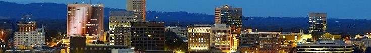
Photo: Carolinaliving, CC BY-SA 3.0.
Greenville has been described as Athens, Georgia for adults. It is the county seat and largest city of Greenville County, South Carolina, United States.
West End
Neighborhood

Photo: Wikimedia, Public domain.
West End is a neighborhood in Greenville, South Carolina. Located across the Reedy River in downtown, the west end became home to Furman University when it was first established in 1852.
Woodside Cotton Mill Village Historic District
Neighborhood
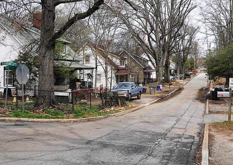
Photo: Bigskybill, CC BY-SA 3.0.
Woodside Cotton Mill Village Historic District is a national historic district located in Greenville County, South Carolina. The district encompasses 278 contributing buildings and 2 contributing sites in an early 20th century urban South Carolina textile mill village.
Plants & Trees
- Type: Sign
- Categories: information and tourism
- Location: Greenville County, South Carolina, South, United States, North America
- View on OpenStreetMap
Latitude
34.85305° or 34° 51′ 11″ northLongitude
-82.41084° or 82° 24′ 39″ westOpen location code
866VVH3Q+6MOpenStreetMap ID
node 10908621676OpenStreetMap feature
tourism=information
This page is based on OpenStreetMap, Wikidata, and Wikimedia Commons.
We’d love your help improving our open data sources. Thank you for contributing.
Satellite Map
Discover Plants & Trees from above in high-definition satellite imagery.
Notable Places Nearby
Highlights include Reedy River Wetlands Preserve and Noel P McKissick Garden.
Nearby Places
Explore places such as Meadow Lot 2 and Marsh Animals.
South Carolina: Must-Visit Destinations
Delve into Columbia, Charleston, Greenville, and Myrtle Beach.
Curious Places to Discover
Uncover intriguing places from every corner of the globe.
About Mapcarta. Data © OpenStreetMap contributors and available under the Open Database License". Text is available under the CC BY-SA 4.0 license, except for photos, directions, and the map. Photo: Rastapopulous, CC BY-SA 3.0.