Koła młyńskie
Koła młyńskie is in Oravská Lesná, Námestovo District, Žilina Region. Koła młyńskie is situated nearby to Church of St. Anne (Oravská Lesná), as well as near the fire station DHZO Oravská Lesná.| Tap on a place to explore it |
Places of Interest Nearby
Highlights include Church of St. Anne (Oravská Lesná).
Church of St. Anne (Oravská Lesná)
Church

Photo: Michal Oparty, Public domain.
Church of St. Anne (Oravská Lesná) is situated 210 metres north of Koła młyńskie.
Places in the Area
Nearby places include Oravská Lesná and Smereków Wielki.
Oravská Lesná
Village
Photo: Michal Oparty, Public domain.
Oravská Lesná is a village and municipality in Námestovo District in the Žilina Region of northern Slovakia.
Smereków Wielki
Hamlet
 Smereków Wielki is a village in the administrative district of Gmina Ujsoły, within Żywiec County, Silesian Voivodeship, in southern Poland, close to the border with Slovakia. Smereków Wielki is situated 8 km north of Koła młyńskie.
Zákamenné
Village
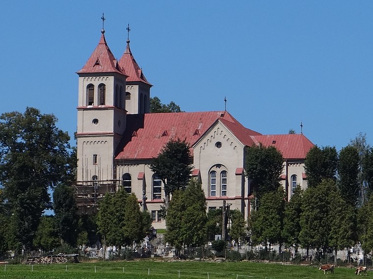
Photo: Wikimedia, CC BY-SA 4.0.
Zákamenné is the biggest village in the Orava region in the northern part of Slovakia. Zákamenné lies in the north-western part of Orava. It belongs to the protected landscape area of Horná Orava and the specially protected area of Horná Orava. Zákamenné is situated 8 km east of Koła młyńskie.
Koła młyńskie
- Type: Tourist attraction
- Wheelchair access: limited
- Category: tourism
- Location: Oravská Lesná, Námestovo District, Žilina Region, Slovakia, Central Europe, Europe
- View on OpenStreetMap
Latitude
49.36664° or 49° 21′ 60″ northLongitude
19.18444° or 19° 11′ 4″ eastOpen location code
8FXX958M+MQOpenStreetMap ID
node 10916021519OpenStreetMap feature
tourism=attractionOpenStreetMap attribute
wheelchair=limited
This page is based on OpenStreetMap, Wikidata, and Wikimedia Commons.
We’d love your help improving our open data sources. Thank you for contributing.
Satellite Map
Discover Koła młyńskie from above in high-definition satellite imagery.
Notable Places Nearby
Highlights include DHZO Oravská Lesná and Oravská Lesná.
Nearby Places
Explore places such as Lesnícky náučný chodník and Vaša Lekáreň.
Slovakia: Must-Visit Destinations
Delve into Bratislava, Košice, Banská Bystrica, and Prešov.
Curious Places to Discover
Uncover intriguing places from every corner of the globe.
About Mapcarta. Data © OpenStreetMap contributors and available under the Open Database License". Text is available under the CC BY-SA 4.0 license, except for photos, directions, and the map. Photo: Danapit, CC BY-SA 3.0.