café frisör
café frisör is a hairdresser in Hildesheim, Hanover Region, Lower Saxony. café frisör is situated nearby to Pelizaeusplatz, as well as near St. Cross Church (Hildesheim).| Tap on a place to explore it |
Places of Interest Nearby
Highlights include St. Cross Church (Hildesheim) and St. Andreas.

St. Andreas
Church

Photo: Wikimedia, CC BY-SA 3.0.
The church of St. Andreas is the principal Lutheran church of Hildesheim, Germany, not to be confounded with the Catholic Hildesheim Cathedral. Its tower is 114.5 metres tall, making it the tallest church tower in Lower Saxony; it is accessible and offers a panoramic view of both the city and surrounding countryside. St. Andreas is situated 220 metres northwest of café frisör.
St. Michael’s Church
Church
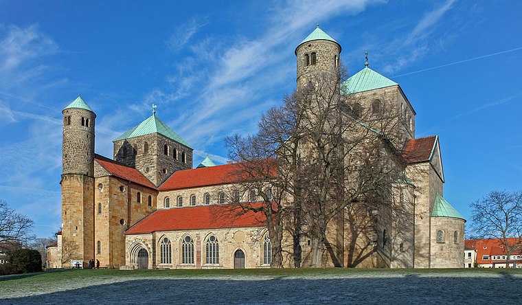
Photo: Heinz-Josef Lücking, CC BY-SA 3.0 de.
The Church of St. Michael is an early-Romanesque church located in Hildesheim, Germany. It has been on the UNESCO World Cultural Heritage list since 1985 due to the before mentioned early-Romanesque architecture and art found within such as the Tree of Jesse and the now relocated Bernward Doors. St. Michael’s Church is situated 670 metres northwest of café frisör.
Places in the Area
Nearby places include Moritzberg and Barienrode.
Moritzberg
Neighborhood
Moritzberg is a quarter in the city of Hildesheim in Lower Saxony, Germany. It is on a hill in the west of the city, about a mile from the Cathedral. It was an independent market town until 1911.
Barienrode
Village

Photo: Torbenbrinker, CC BY-SA 3.0.
Barienrode is a village, which is situated 4 km south of café frisör.
Asel (Harsum)
Village
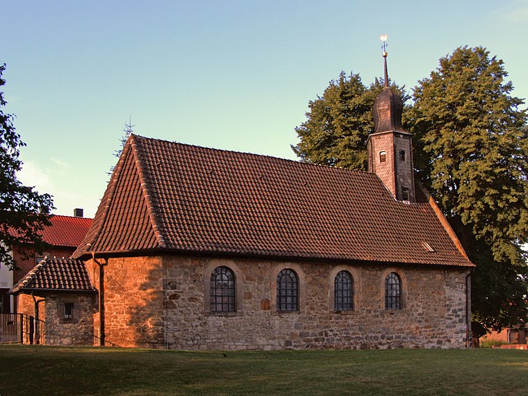
Photo: Kirchenfan, CC0.
Asel (Harsum) is a village, which is situated 5 km north of café frisör.
café frisör
- Type: Hairdresser
- Category: shop
- Location: Hildesheim, Hildesheim, Hanover Region, Lower Saxony, Germany, Central Europe, Europe
- View on OpenStreetMap
Latitude
52.14994° or 52° 8′ 60″ northLongitude
9.9519° or 9° 57′ 7″ eastOpen location code
9F4F4XX2+XQOpenStreetMap ID
node 10960324343OpenStreetMap feature
shop=hairdresser
This page is based on OpenStreetMap, Wikidata, and Wikimedia Commons.
We’d love your help improving our open data sources. Thank you for contributing.
Satellite Map
Discover café frisör from above in high-definition satellite imagery.
Notable Places Nearby
Highlights include Pelizaeusplatz and Tom2Rock.
Nearby Places
Explore places such as Potter’s Bar and Sogno Mio.
Hanover Region: Must-Visit Destinations
Delve into Hanover, Nienburg, Verden an der Aller, and Alfeld.
Curious Hairdressers to Discover
Uncover intriguing hairdressers from every corner of the globe.
About Mapcarta. Data © OpenStreetMap contributors and available under the Open Database License". Text is available under the CC BY-SA 4.0 license, except for photos, directions, and the map. Photo: Mey2008, CC BY-SA 3.0.