Catering Harz
Catering Harz is in Blankenburg, Harz, Saxony-Anhalt, and is located on Friedensstraße. Catering Harz is situated nearby to the water park Freibad Am Thie, as well as near the sports venue Sporthalle Gymnasium ‘Am Thie’.| Tap on a place to explore it |
Places of Interest Nearby
Highlights include Blankenburg station and Sportforum Blankenburg.
Blankenburg station
Railway station
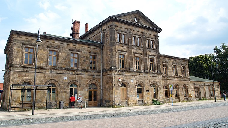
Photo: Angela Huster, CC0.
Blankenburg station is the most important station in Blankenburg in the Saxony-Anhalt district of Harz in central Germany. Blankenburg station is situated 600 metres east of Catering Harz.
Sportforum Blankenburg
Sports venue

Photo: Wikimedia, CC BY-SA 3.0 de.
Sportforum Blankenburg is a sports venue, which is situated 310 metres northeast of Catering Harz.
Gymnasium Am Thie
School

Photo: Adkott2, CC BY-SA 4.0.
Gymnasium Am Thie is a school, which is situated 280 metres east of Catering Harz.
Places in the Area
Nearby places include Wendefurth and Langenstein.
Wendefurth
Hamlet

Photo: B.Thomas95, CC BY-SA 4.0.
Wendefurth is a hamlet in central Germany that, since 1 July 2009, has been part of the borough of Thale district of Harz. Previously it belonged to the municipality of Altenbrak which was incorporated into Thale. Wendefurth is situated 7 km south of Catering Harz.
Langenstein
Village

Photo: B.Thomas95, CC BY-SA 4.0.
Langenstein is a village and a former municipality in the district of Harz, in Saxony-Anhalt, Germany. Since 1 January 2010, it is part of the town Halberstadt. The World War II concentration camp Langenstein-Zwieberge was located here. Langenstein is situated 7 km north of Catering Harz.
Neuwerk
Village

Photo: Wikimedia, CC BY-SA 3.0.
Neuwerk is a village, which is situated 7 km southwest of Catering Harz.
Catering Harz
- Type: Catering
- Address: Friedensstraße 3, Blankenburg (Harz), 38889
- Category: workshop
- Location: Blankenburg, Harz, Saxony-Anhalt, Germany, Central Europe, Europe
- View on OpenStreetMap
Latitude
51.79629° or 51° 47′ 47″ northLongitude
10.95259° or 10° 57′ 9″ eastOpen location code
9F3GQXW3+G2OpenStreetMap ID
node 10982396061OpenStreetMap feature
craft=caterer
This page is based on OpenStreetMap, Wikidata, and Wikimedia Commons.
We’d love your help improving our open data sources. Thank you for contributing.
Satellite Map
Discover Catering Harz from above in high-definition satellite imagery.
Notable Places Nearby
Highlights include Freibad Am Thie and Sporthalle Gymnasium ‘Am Thie’.
Nearby Places
Explore places such as Zum alten Schützenhaus and Blankenburg, Friedensstraße.
Saxony-Anhalt: Must-Visit Destinations
Delve into Magdeburg, Halle, Wittenberg, and Quedlinburg.
Curious Places to Discover
Uncover intriguing places from every corner of the globe.
About Mapcarta. Data © OpenStreetMap contributors and available under the Open Database License". Text is available under the CC BY-SA 4.0 license, except for photos, directions, and the map. Photo: Mr. TI., CC BY 3.0.