Twenty eight S.
Twenty eight S. is a hairdresser in Starnberg, Upper Bavaria, Bavaria which is located on Weilheimer Straße. Twenty eight S. is situated nearby to the playground Spielplatz Emslanderstraße, as well as near the park Almeidawiese.| Tap on a place to explore it |
- Type: Hairdresser
- Address: Weilheimer Straße 15G, Starnberg, 82319
- Wheelchair access: limited
Places of Interest Nearby
Highlights include Lake Starnberg Museum and St. Joseph’s Church, Starnberg.
Lake Starnberg Museum
Museum

Photo: Boschfoto, CC BY-SA 3.0.
Lake Starnberg Museum is situated 710 metres northeast of Twenty eight S..
St. Joseph’s Church, Starnberg
Church

Photo: Schwittus, CC BY-SA 3.0.
St. Joseph is a Rococo church in Starnberg, Bavaria, Germany. It was built in the second half of the 18th century. The high altar of the church was created by Ignaz Günther. St. Joseph’s Church, Starnberg is situated 1 km northeast of Twenty eight S..
Starnberg station
Railway station

Photo: AHert, CC BY-SA 3.0.
Starnberg station is a railway station in the municipality of Starnberg, in Bavaria, Germany. It is located on the Munich–Garmisch-Partenkirchen railway of Deutsche Bahn. Starnberg station is situated 1 km northeast of Twenty eight S..
Places in the Area
Nearby places include Söcking and Maising.

Maising
Village
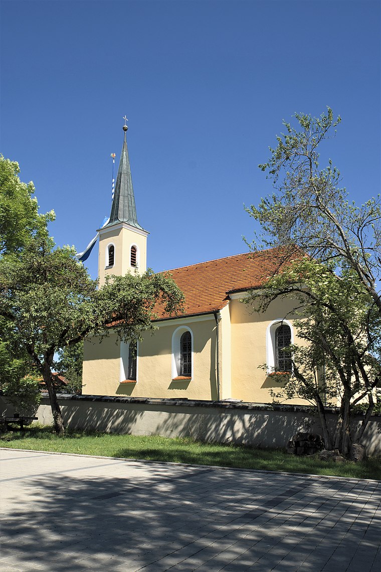
Photo: GFreihalter, CC BY-SA 3.0.
Maising is a village, which is situated 3 km west of Twenty eight S..
Berg
Village

Photo: Walter Berg, CC BY 3.0.
Berg is a municipality in the district of Starnberg in Bavaria, Germany, on the shore of the Starnberg Lake. It is most famous for the royal Berg Castle. Berg is situated 3 km southeast of Twenty eight S..
Twenty eight S.
- Category: shop
- Location: Starnberg, Starnberg, Upper Bavaria, Bavaria, Germany, Central Europe, Europe
- View on OpenStreetMap
Latitude
47.99168° or 47° 59′ 30″ northLongitude
11.33168° or 11° 19′ 54″ eastOpen location code
8FVHX8RJ+MMOpenStreetMap ID
node 10997442845OpenStreetMap feature
shop=hairdresserOpenStreetMap attribute
wheelchair=limited
This page is based on OpenStreetMap, Wikidata, and Wikimedia Commons.
We’d love your help improving our open data sources. Thank you for contributing.
Satellite Map
Discover Twenty eight S. from above in high-definition satellite imagery.
Notable Places Nearby
Highlights include Spielplatz Emslanderstraße and Almeidawiese.
Nearby Places
Explore places such as Pichcha Traditionelle Thaimassage and Finest Bikes.
Upper Bavaria: Must-Visit Destinations
Delve into Munich, Ingolstadt, Rosenheim, and Dachau.
Curious Hairdressers to Discover
Uncover intriguing hairdressers from every corner of the globe.
About Mapcarta. Data © OpenStreetMap contributors and available under the Open Database License". Text is available under the CC BY-SA 4.0 license, except for photos, directions, and the map. Photo: Aconcagua, CC BY-SA 3.0.