Hoger
Hoger is in Mosnang, Toggenburg, Canton of St. Gallen. Hoger is situated nearby to the scenic viewpoint Alewindebööl, as well as near the peak Silberbüel.| Tap on a place to explore it |
Places of Interest Nearby
Highlights include Hörnli and St Anne’s Catholic Church.
Hörnli
Scenic viewpoint

Photo: Albireo, CC BY-SA 3.0.
Hörnli mountain is located on the territory of the community of Fischenthal, in the Zürcher Oberland, in the eastern part of canton of Zürich, in Switzerland. Hörnli is situated 1½ km southwest of Hoger.
St Anne’s Catholic Church
Church
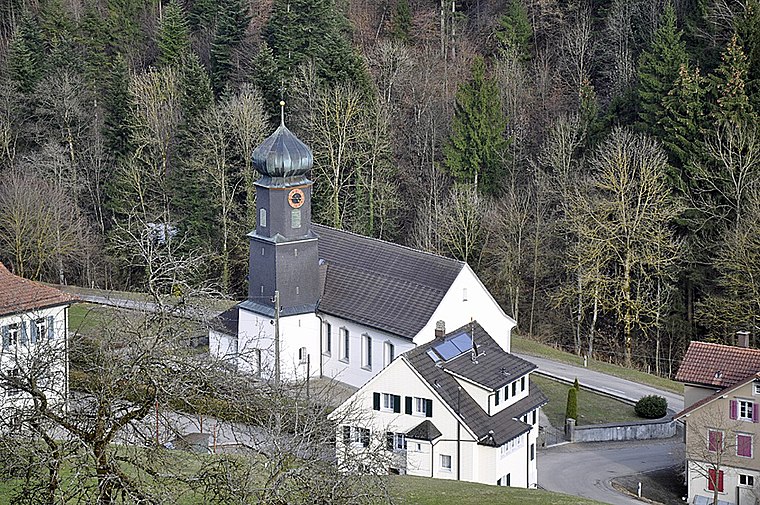
Photo: Waldteufel78, CC BY-SA 3.0.
St Anne’s Catholic Church is situated 1½ km north of Hoger.

Places in the Area
Nearby places include Mühlrüti and Sternenberg.
Mühlrüti
Hamlet
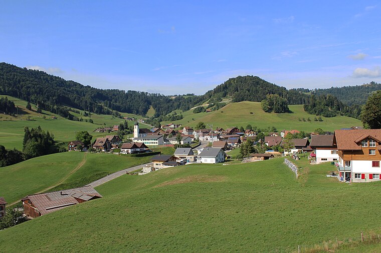
Photo: 1-Byte, CC BY-SA 4.0.
Mühlrüti is a small town in the Canton of St. Gallen in Switzerland. It is part of the municipality of Mosnang in Toggenburg, in hilly northeastern Switzerland. The population of about 400 people works mainly in the dairy farming industry. Mühlrüti is situated 2½ km southeast of Hoger.
Sternenberg
Village

Photo: Wikimedia, CC BY-SA 3.0.
Sternenberg is a former municipality in the district of Pfäffikon in the canton of Zürich in Switzerland. Bauma and Sternenberg merged to Bauma on 1 January 2015. Sternenberg is situated 3 km west of Hoger.
Fischingen
Village

Photo: Berger, Public domain.
Fischingen is a municipality in the district of Münchwilen in the canton of Thurgau in Switzerland. Fischingen is situated 4 km north of Hoger.
Hoger
- Type: Sign
- Categories: information and tourism
- Location: Mosnang, Toggenburg, Canton of St. Gallen, Switzerland, Central Europe, Europe
- View on OpenStreetMap
Latitude
47.38425° or 47° 23′ 3″ northLongitude
8.95326° or 8° 57′ 12″ eastOpen location code
8FVC9XM3+P8OpenStreetMap ID
node 11018446257OpenStreetMap feature
tourism=information
This page is based on OpenStreetMap, Wikidata, and Wikimedia Commons.
We’d love your help improving our open data sources. Thank you for contributing.
Satellite Map
Discover Hoger from above in high-definition satellite imagery.
Places with the Same Name
Discover other places named “Hoger”.
Notable Places Nearby
Highlights include Alewindebööl and Silberbüel.
Nearby Places
Explore places such as Holenstein and Allenwinden.
Switzerland: Must-Visit Destinations
Delve into Zurich, Berne, Geneva, and Basel.
Curious Places to Discover
Uncover intriguing places from every corner of the globe.
About Mapcarta. Data © OpenStreetMap contributors and available under the Open Database License". Text is available under the CC BY-SA 4.0 license, except for photos, directions, and the map. Photo: EtschPat, CC BY-SA 4.0.