13 - Učna pot: Pri kapelici
13 - Učna pot: Pri kapelici is in Medvode, Slovenia. 13 - Učna pot: Pri kapelici is situated nearby to the peak Jetrbenk, as well as near Pehar.| Tap on a place to explore it |
Places of Interest Nearby
Highlights include Slavkov dom na Golem brdu.
Slavkov dom na Golem brdu
Restaurant
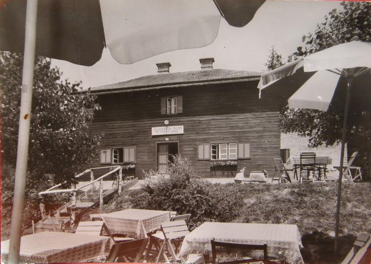
Photo: Wikimedia, Public domain.
Slavkov dom na Golem brdu is a restaurant, which is situated 2½ km east of 13 - Učna pot: Pri kapelici.
Places in the Area
Nearby places include Brezovica pri Medvodah and Topol pri Medvodah.
Brezovica pri Medvodah
Village

Photo: Doremo, CC BY-SA 4.0.
Brezovica pri Medvodah is a small settlement in the Municipality of Medvode in the Upper Carniola region of Slovenia.
Topol pri Medvodah
Village

Photo: Doremo, CC BY-SA 3.0.
Topol pri Medvodah is a small settlement in the Municipality of Medvode in the Upper Carniola region of Slovenia. It lies in the hills northwest of the Slovene capital Ljubljana and is a popular destination for short trips with locals.
Osredek pri Dobrovi
Village

Photo: Doremo, CC BY-SA 3.0.
Osredek pri Dobrovi is a village in the hills northwest of Dobrova in the Municipality of Dobrova–Polhov Gradec in the Upper Carniola region of Slovenia.
13 - Učna pot: Pri kapelici
- Type: Sign
- Categories: information and tourism
- Location: Medvode, Slovenia, Central Europe, Europe
- View on OpenStreetMap
Latitude
46.10058° or 46° 6′ 2″ northLongitude
14.38393° or 14° 23′ 2″ eastOpen location code
8FRP492M+6HOpenStreetMap ID
node 11062952486OpenStreetMap feature
tourism=information
This page is based on OpenStreetMap, Wikidata, and Wikimedia Commons.
We’d love your help improving our open data sources. Thank you for contributing.
Satellite Map
Discover 13 - Učna pot: Pri kapelici from above in high-definition satellite imagery.
Notable Places Nearby
Highlights include Jetrbenk and Pehar.
Nearby Places
Explore places such as Po sledeh divjega petelina and Pojzder.
Slovenia: Must-Visit Destinations
Delve into Ljubljana, Maribor, Koper, and Celje.
Curious Places to Discover
Uncover intriguing places from every corner of the globe.
About Mapcarta. Data © OpenStreetMap contributors and available under the Open Database License". Text is available under the CC BY-SA 4.0 license, except for photos, directions, and the map. Photo: Jjtkk, CC BY 3.0.