Les Arcets (Nord)
Les Arcets (Nord) is in La Clusaz, Arrondissement of Annecy, Auvergne-Rhône-Alpes and has an elevation of 1,430 metres. Les Arcets (Nord) is situated nearby to the mountain saddle Les Confins, as well as near the golf course Golf du Grand-Bornand.| Tap on a place to explore it |
Places of Interest Nearby
Highlights include Les Confins and Chapelle des Confins.

Chapelle des Confins
Church
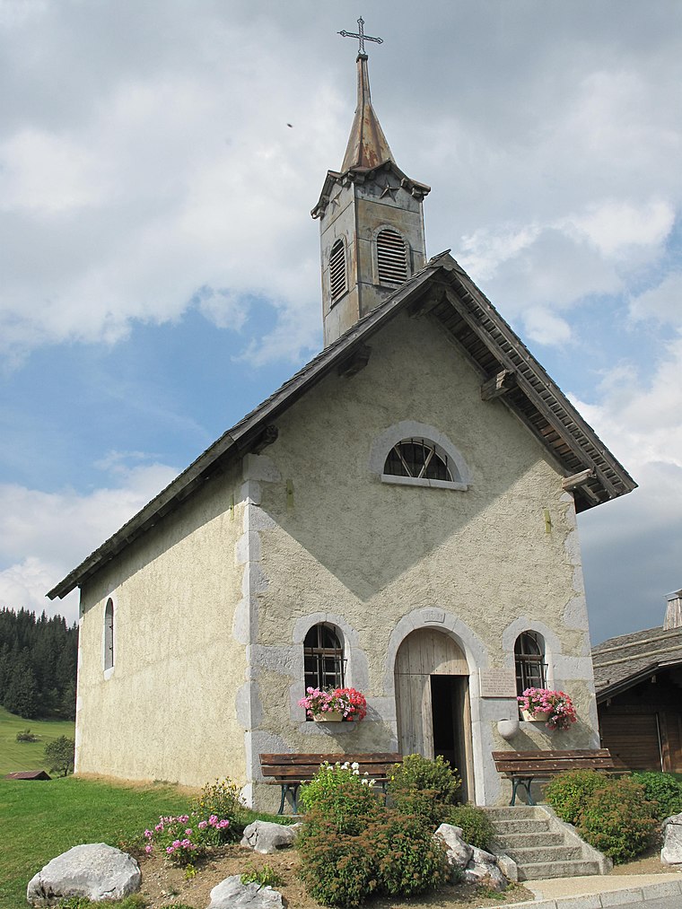
Photo: Tangopaso, Public domain.
Chapelle des Confins is a church, which is situated 1 km south of Les Arcets (Nord).
Chapelle des Plans du Grand-Bornand
Church

Photo: Guilhem Vellut, CC BY 2.0.
Chapelle des Plans du Grand-Bornand is a church, which is situated 1 km north of Les Arcets (Nord).
Places in the Area
Nearby places include Le Grand-Bornand and Saint-Jean-de-Sixt.
Le Grand-Bornand
Village

Photo: Gegeours, CC BY-SA 3.0.
Le Grand-Bornand is a commune in the eastern French department of Haute-Savoie. The commune is a ski resort and takes its name from the river that runs through it. The inhabitants of Le Grand-Bornand are called Bornandins. Le Grand-Bornand is situated 4½ km west of Les Arcets (Nord).
Saint-Jean-de-Sixt
Village

Photo: Zivax, CC BY-SA 3.0.
Saint-Jean-de-Sixt is a commune in the Haute-Savoie department in the Auvergne-Rhône-Alpes region in southeastern France. It lies in the Aravis Range of the French Alps. Saint-Jean-de-Sixt is situated 5 km west of Les Arcets (Nord).
Les Villards-sur-Thônes
Village

Photo: Wikimedia, CC BY-SA 4.0.
Les Villards-sur-Thônes is a commune in the Haute-Savoie department in the Auvergne-Rhône-Alpes region in south-eastern France. Les Villards-sur-Thônes is situated 9 km west of Les Arcets (Nord).
Les Arcets (Nord)
- Type: Sign
- Categories: information and tourism
- Location: La Clusaz, Arrondissement of Annecy, Haute-Savoie, Auvergne-Rhône-Alpes, France, Europe
- View on OpenStreetMap
Latitude
45.92767° or 45° 55′ 40″ northLongitude
6.48117° or 6° 28′ 52″ eastElevation
1,430 metres (4,692 feet)Operator
CC Vallées de ThônesOpen location code
8FQ8WFHJ+3FOpenStreetMap ID
node 11118529814OpenStreetMap feature
tourism=information
This page is based on OpenStreetMap, Wikidata, and Wikimedia Commons.
We’d love your help improving our open data sources. Thank you for contributing.
Satellite Map
Discover Les Arcets (Nord) from above in high-definition satellite imagery.
Notable Places Nearby
Highlights include Golf du Grand-Bornand and Golf des Confins.
Nearby Places
Explore places such as Les Arcets (sud) and Sur les Ascets.
Haute-Savoie: Must-Visit Destinations
Delve into Chamonix, Annecy, Annemasse, and Evian.
Curious Places to Discover
Uncover intriguing places from every corner of the globe.
About Mapcarta. Data © OpenStreetMap contributors and available under the Open Database License". Text is available under the CC BY-SA 4.0 license, except for photos, directions, and the map. Photo: KlausFoehl, CC BY-SA 3.0.