Soleck
Soleck is a peak in Lesachtal, Hermagor District, Carinthia and has an elevation of 2,221 metres. Soleck is situated nearby to the hamlet Tuffbad, as well as near the locality Im Bruch.| Tap on a place to explore it |
Places of Interest
Highlights include Riebenkofel and Wilde Sender.
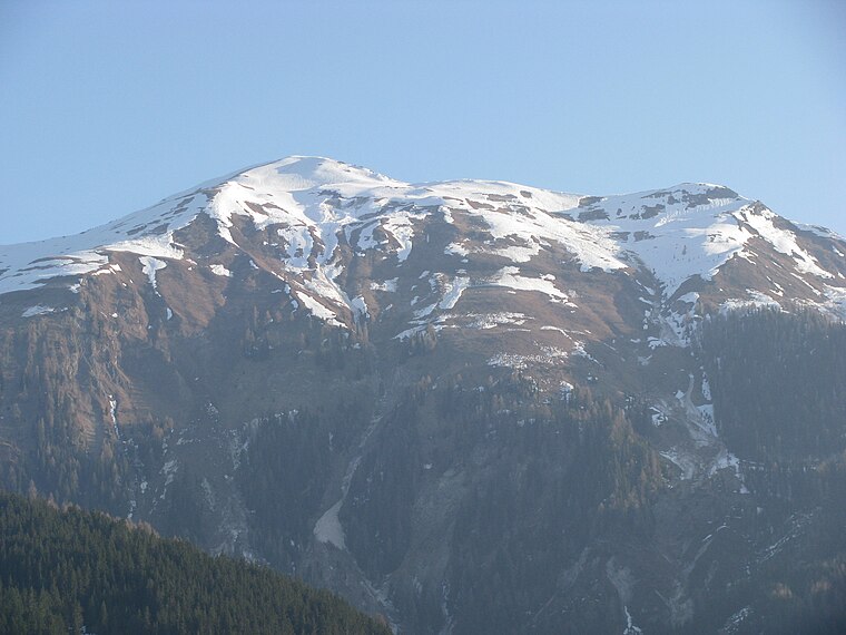

Große Sandspitze
Peak

Photo: Wikimedia, Public domain.
The Große Sandspitze in Tyrol is 2,770 m and the highest mountain in the Gailtal Alps, a mountain range of the Southern Limestone Alps. It is located within the subrange of the Lienz Dolomites and is locally called the Sunnspitz.
Places in the Area
Nearby places include Wiesen and Klebas.

Klebas
Hamlet

Photo: Naturpuur, CC BY-SA 4.0.
Klebas is one of the 31 localities belonging to the municipality of Lesachtal in Carinthia.

Soleck
- Type: Peak with an elevation of 2,221 metres
- Description: mountain in the Gailtal Alps in Carinthia
- Categories: mountain and landform
- Location: Lesachtal, Hermagor District, Carinthia, Austria, Central Europe, Europe
- View on OpenStreetMap
Latitude
46.7363° or 46° 44′ 11″ northLongitude
12.7915° or 12° 47′ 30″ eastElevation
2,221 metres (7,287 feet)Open location code
8FRJPQPR+GJOpenStreetMap ID
node 1120066757OpenStreetMap feature
natural=peakWikidata ID
Q9339316
This page is based on OpenStreetMap, Wikidata, and Wikimedia Commons.
We’d love your help improving our open data sources. Thank you for contributing.
Satellite Map
Discover Soleck from above in high-definition satellite imagery.
In Other Languages
From German to Polish—“Soleck” goes by many names.
- German: “Soleck”
- Polish: “Soleck”
Localities in the Area
Explore places such as Tuffbad and Im Bruch.
Notable Places Nearby
Highlights include Politzen and Böses Weibele.
Carinthia: Must-Visit Destinations
Delve into Klagenfurt, Villach, Wörthersee, and Spittal an der Drau.
Curious Peaks to Discover
Uncover intriguing peaks from every corner of the globe.
About Mapcarta. Data © OpenStreetMap contributors and available under the Open Database License". Text is available under the CC BY-SA 4.0 license, except for photos, directions, and the map. Photo: Reinhard Müller, CC BY-SA 4.0.