Agjencia Shtetërore e Kadastrës
Agjencia Shtetërore e Kadastrës is a government office in Elbasan, Southeastern Albania which is located on Rruga 28 Nëntori. Agjencia Shtetërore e Kadastrës is situated nearby to the government office Agency for the Delivery of Integrated Services Albania, as well as near the marketplace Lé Parfume.| Tap on a place to explore it |
Places of Interest Nearby
Highlights include Elbasan Castle and Elbasan Arena.
Elbasan Castle
 Elbasan Castle is a 15th-century fortress in the city of Elbasan, Albania. Elbasan Castle is situated 450 metres southwest of Agjencia Shtetërore e Kadastrës.
Elbasan Arena
Stadium
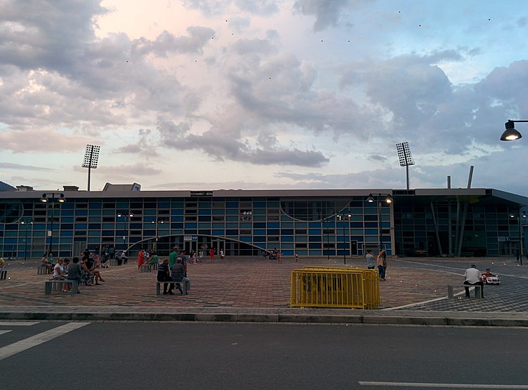
Photo: Leeturtle, CC BY-SA 3.0.
Elbasan Arena is a multi-purpose stadium in Elbasan, Albania. The stadium was completed in 1967 and has been the home ground of KF Elbasani ever since. Elbasan Arena is situated 680 metres east of Agjencia Shtetërore e Kadastrës.
Saint Mary Elbasan
Church

Photo: Pasztilla, CC BY-SA 4.0.
The St. Mary's Church is an Albanian Orthodox church and monastery in Elbasan, Albania. It became a Cultural Monument of Albania in 1963. The church's building started in 1483 in the Vlach neighborhood, but it ended almost a century later: the church had its first religious services only in 1556. Saint Mary Elbasan is situated 340 metres southwest of Agjencia Shtetërore e Kadastrës.
Places in the Area
Nearby places include Scampis and Bradashesh.

Bradashesh
Village
Bradashesh is a village and a former municipality in Elbasan County, central Albania. At the 2015 local government reform it became a subdivision of the municipality Elbasan. Bradashesh is situated 5 km west of Agjencia Shtetërore e Kadastrës.
Labinot-Fushë
Village

Photo: Pasztilla, CC BY-SA 4.0.
Labinot-Fushë is a village and a former municipality in the Elbasan County, central Albania. At the 2015 local government reform it became a subdivision of the municipality Elbasan. Labinot-Fushë is situated 7 km northeast of Agjencia Shtetërore e Kadastrës.
Agjencia Shtetërore e Kadastrës
- Type: Government office
- Address: Rruga 28 Nëntori, Elbasan
- Categories: office and government building
- Location: Elbasan, Elbasan County, Southeastern Albania, Albania, Balkans, Europe
- View on OpenStreetMap
Latitude
41.11689° or 41° 7′ 1″ northLongitude
20.08404° or 20° 5′ 3″ eastOpen location code
8GH2438M+QJOpenStreetMap ID
node 11206413464OpenStreetMap feature
office=government
This page is based on OpenStreetMap, Wikidata, and Wikimedia Commons.
We’d love your help improving our open data sources. Thank you for contributing.
Satellite Map
Discover Agjencia Shtetërore e Kadastrës from above in high-definition satellite imagery.
Places with the Same Name
Discover other places named “Agjencia Shtetërore e Kadastrës”.
Notable Places Nearby
Highlights include Agency for the Delivery of Integrated Services Albania and Lé Parfume.
Nearby Places
Explore places such as Gala and Farmaci BIO Farma.
Southeastern Albania: Must-Visit Destinations
Delve into Berat, Korçë, Gjirokastër, and Pogradec.
Curious Government Offices to Discover
Uncover intriguing government offices from every corner of the globe.
About Mapcarta. Data © OpenStreetMap contributors and available under the Open Database License". Text is available under the CC BY-SA 4.0 license, except for photos, directions, and the map. Photo: Albinfo, CC BY 4.0.