Jöfurbás
Jöfurbás is a bus stop in Reykjavík, Capital Region. Jöfurbás is situated nearby to Hallstein’s Park, as well as near the amusement ride Skemmtigarðurinn Paintball.| Tap on a place to explore it |
Places of Interest Nearby
Highlights include Imagine Peace Tower and Egilshöll.
Imagine Peace Tower
Memorial

Photo: McKay Savage, CC BY 2.0.
The Imagine Peace Tower is a memorial to John Lennon from his widow, Yoko Ono, located on Viðey Island in Kollafjörður Bay near Reykjavík, Iceland. Installed in 2007, it consists of a tall tower of light, projected from a white stone monument that has the words "Imagine Peace" carved into it in 24 languages. Imagine Peace Tower is situated 3 km west of Jöfurbás.
Egilshöll
Egilshöll, also known as Egilshöllin, is a multi-purpose sports and entertainment facility located in the Grafarvogur district of Iceland's capital Reykjavík. Egilshöll is situated 2 km southeast of Jöfurbás.Kleppur
Hospital
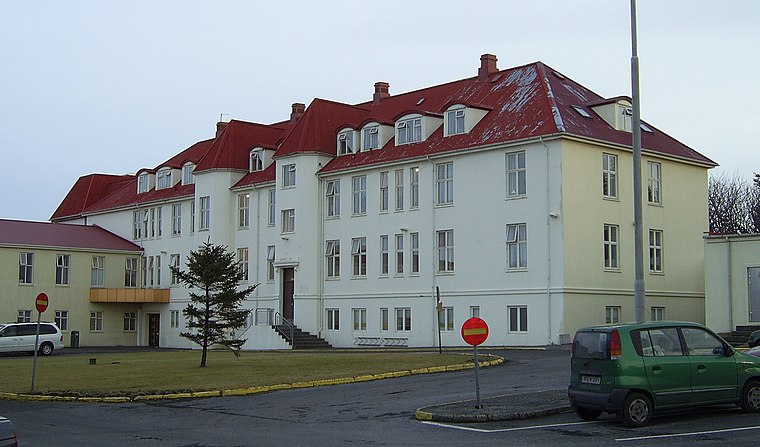
Photo: Gdh, CC BY-SA 3.0.
Kleppur or Kleppsspítali is an Icelandic psychiatric hospital that is operated by The National University Hospital of Iceland. The first laws concerning Kleppur were nr. Kleppur is situated 2½ km southwest of Jöfurbás.
Places in the Area
Nearby places include Kópavogur and Garðabaer.
Kópavogur

Photo: Axel Kristinsson, CC BY 2.0.
Kópavogur is a town in Iceland that is the country's second-largest municipality by population. It lies immediately south of Reykjavík and is part of the Capital Region.
Garðabaer
Town

Photo: Wikimedia, Public domain.
Garðabær is a town and municipality in the Capital Region of Iceland. Garðabaer is situated 9 km southwest of Jöfurbás.
Grundarhverfi
Village
Kjalarnes is the least populous district in the municipality of Reykjavík, the capital of Iceland, with a population of around 600 inhabitants. Grundarhverfi is situated 10 km north of Jöfurbás.
Jöfurbás
- Type: Bus stop
- Categories: transport stop and transportation
- Location: Reykjavík, Capital Region, Southwest Iceland, Iceland, Nordic countries, Europe
- View on OpenStreetMap
Latitude
64.15428° or 64° 9′ 15″ northLongitude
-21.80585° or 21° 48′ 21″ westOpen location code
99PW553V+PMOpenStreetMap ID
node 11266921830OpenStreetMap feature
public_transport=stop_position
This page is based on OpenStreetMap, Wikidata, and Wikimedia Commons.
We’d love your help improving our open data sources. Thank you for contributing.
Satellite Map
Discover Jöfurbás from above in high-definition satellite imagery.
Notable Places Nearby
Highlights include Hallstein’s Park and Skemmtigarðurinn Paintball.
Nearby Places
Explore places such as Jöfurbás and Hallsteinsgarður.
Southwest Iceland: Must-Visit Destinations
Delve into Kópavogur, Hafnarfjörður, Keflavík, and Keflavík International Airport.
Curious Bus Stops to Discover
Uncover intriguing bus stops from every corner of the globe.
About Mapcarta. Data © OpenStreetMap contributors and available under the Open Database License". Text is available under the CC BY-SA 4.0 license, except for photos, directions, and the map. Photo: Napoleon tnt, CC BY-SA 3.0.