Diocesan Girls‘ School
Diocesan Girls' School is one of the oldest girls' schools in Hong Kong, operated by the Anglican Hong Kong Sheng Kung Hui to provide a well-rounded secondary education for girls.| Tap on a place to explore it |
- Type: School
- Description: secondary school in Hong Kong
- Also known as: “DGS” and “Diocesan Girls’ School”
Places of Interest Nearby
Highlights include Queen Elizabeth Hospital and Kowloon Union Church.
Queen Elizabeth Hospital
Hospital

Photo: Wing1990hk, CC BY 3.0.
Queen Elizabeth Hospital, abbreviated as QE or QEH, is one of the largest district general hospital in Hong Kong. It was named after Queen Elizabeth II. Queen Elizabeth Hospital is situated 260 metres northeast of Diocesan Girls‘ School.
Kowloon Union Church
Church

Photo: Chong Fat, Public domain.
Kowloon Union Church is a church in Jordan, Hong Kong. Located at 4 Jordan Road, it is a declared monument. Kowloon Union Church is situated 130 metres south of Diocesan Girls‘ School.
Kowloon Cricket Club
Sports venue

Photo: 1841Hongkong, CC BY-SA 4.0.
The Kowloon Cricket Club, also called KCC, is a members only cricket club and social club situated in Kowloon, Hong Kong, on Cox's Road. Kowloon Cricket Club is situated 240 metres southeast of Diocesan Girls‘ School.
Places in the Area
Nearby places include Kings Park and Yung Shue Tau.
Yung Shue Tau
Locality

Photo: Kamdooriepang, CC BY-SA 3.0.
Yung Shue Tau is the public square in front of the Tin Hau Temple in Yau Ma Tei of Kowloon in Hong Kong. The name in Cantonese means banyan tree head, and many banyan trees are still there.
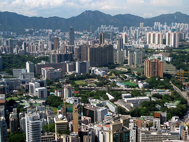
Kowloon

Photo: Wikimedia, CC BY-SA 2.0.
Kowloon is an urban peninsula on the mainland part of Hong Kong, directly across from the Hong Kong Island central business district. With over 2 million people living in an area of less than 47 km², Kowloon is one of the most densely populated places on the planet, and has a matching array of places to shop, eat and sleep.
Diocesan Girls‘ School
- Categories: secondary school and education
- Location: Yau Tsim Mong District, Hong Kong, East Asia, Asia
- View on OpenStreetMap
Latitude
22.30686° or 22° 18′ 25″ northLongitude
114.17302° or 114° 10′ 23″ eastOpen location code
7PJP854F+P6OpenStreetMap ID
node 11283419237OpenStreetMap feature
amenity=schoolWikidata ID
Q5278782
This page is based on OpenStreetMap, Wikidata, Wikimedia Commons, and Wikipedia.
We’d love your help improving our open data sources. Thank you for contributing.
Satellite Map
Discover Diocesan Girls‘ School from above in high-definition satellite imagery.
In Other Languages
From Chinese to Yue Chinese—“Diocesan Girls‘ School” goes by many names.
- Chinese: “DGJS”
- Chinese: “DGS”
- Chinese: “女拔”
- Chinese: “女拔萃”
- Chinese: “拔萃女书院”
- Chinese: “拔萃女子訓練學校”
- Chinese: “拔萃女書院”
- Japanese: “抜萃女書院”
- Swedish: “Diocesan Girls‘ School”
- Yue Chinese: “Diocesan Girls‘ School”
- Yue Chinese: “拔萃女書院”
Notable Places Nearby
Highlights include Diocesan Girls‘ Junior School and Labour Tribunal.
Nearby Places
Explore places such as Diocesan Girls‘ School and Diocesan Girls’ Junior School and Pacific Ocean Sports Center.
Hong Kong: Must-Visit Destinations
Delve into Kowloon, Hong Kong International Airport, Outlying Islands, and Central Hong Kong.
Curious Places to Discover
Uncover intriguing places from every corner of the globe.
About Mapcarta. Data © OpenStreetMap contributors and available under the Open Database License". Text is available under the CC BY-SA 4.0 license, except for photos, directions, and the map. Description text is based on the Wikipedia page “Diocesan Girls‘ School”. Photo: Base64, CC BY-SA 3.0.