St. Stephan, Bahnhof
St. Stephan, Bahnhof is a bus stop in St. Stephan, Obersimmental-Saanen, Canton of Bern. St. Stephan, Bahnhof is situated nearby to St. Stephan railway station, as well as near the peak Mutzeflue.| Tap on a place to explore it |
Places of Interest Nearby
Highlights include St. Stephan railway station and St Stephan.
St. Stephan railway station
Railway station
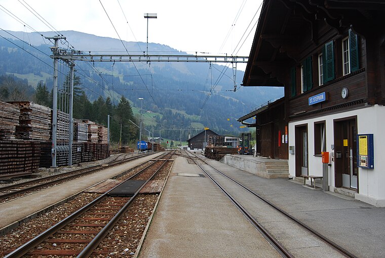
Photo: DidiWeidmann, CC BY-SA 3.0.
St. Stephan railway station is a railway station in the municipality of St. Stephan, in the Swiss canton of Bern. It is an intermediate stop on the 1,000 mm Montreux–Lenk im Simmental line of the Montreux Oberland Bernois Railway.
St Stephan
Aerodrome

Photo: Carsten Steger, CC BY-SA 4.0.
St Stephan is an aerodrome, which is situated 1¼ km southeast of St. Stephan, Bahnhof.
Stöckli railway station
Railway station
 Stöckli railway station is a railway station in St. Stephan, Switzerland. It is an intermediate stop on the 1,000 mm Montreux–Lenk im Simmental line of the Montreux Oberland Bernois Railway. Stöckli railway station is situated 1½ km northwest of St. Stephan, Bahnhof.
Places in the Area
Nearby places include Zweisimmen and Lenk im Simmental.
Zweisimmen
Village

Photo: Gürbetaler, CC BY-SA 4.0.
Zweisimmen is a municipality in the Obersimmental-Saanen administrative district in the canton of Bern in Switzerland. Zweisimmen is situated 6 km north of St. Stephan, Bahnhof.
Lenk im Simmental
Village

Photo: Wikimedia, CC BY-SA 3.0.
Lenk im Simmental is a municipality in the Obersimmental-Saanen administrative district in the canton of Bern in Switzerland. Lenk im Simmental is situated 6 km southeast of St. Stephan, Bahnhof.
Gstaad

Photo: Patrick Nouhailler’s…, CC BY-SA 3.0.
Gstaad is a mountain resort in the Bernese Highlands in Switzerland. The village is at 1050 m altitude, with local skiing only up to 2200 m, but it's linked by ski-lift to the higher areas of Les Diablerets.
St. Stephan, Bahnhof
- Type: Bus stop
- Categories: transport stop and transportation
- Location: St. Stephan, Obersimmental-Saanen, Canton of Bern, Switzerland, Central Europe, Europe
- View on OpenStreetMap
Latitude
46.5054° or 46° 30′ 20″ northLongitude
7.40105° or 7° 24′ 4″ eastOpen location code
8FR9GC42+5COpenStreetMap ID
node 1129263214OpenStreetMap feature
highway=bus_stopOpenStreetMap feature
public_transport=stop_position
This page is based on OpenStreetMap, Wikidata, and Wikimedia Commons.
We’d love your help improving our open data sources. Thank you for contributing.
Satellite Map
Discover St. Stephan, Bahnhof from above in high-definition satellite imagery.
Notable Places Nearby
Highlights include Mutzeflue and Löösli.
Nearby Places
Explore places such as St. Stephan and Mehrzweckhalle.
Switzerland: Must-Visit Destinations
Delve into Zurich, Berne, Geneva, and Basel.
Curious Bus Stops to Discover
Uncover intriguing bus stops from every corner of the globe.
About Mapcarta. Data © OpenStreetMap contributors and available under the Open Database License". Text is available under the CC BY-SA 4.0 license, except for photos, directions, and the map. Photo: Simonizer, CC BY-SA 2.0 de.