Discgolf Davos
Discgolf Davos is a disc golf course in Davos, Graubünden. Discgolf Davos is situated nearby to the church Tschuggen Kapelle, as well as near the peak Baslersch Chopf.| Tap on a place to explore it |
Places of Interest Nearby
Highlights include Sentischhorn and Gorihorn.
Sentischhorn
Peak

Photo: Capricorn4049, CC BY-SA 4.0.
The Sentischhorn is a mountain of the Albula Alps, located east of Davos in the canton of Graubünden. It lies on the range west of the Flüela Pass, that culminates at the Flüela Schwarzhorn.
Gorihorn
Peak

Photo: Capricorn4049, CC BY-SA 4.0.
The Gorihorn is a mountain of the Silvretta Alps, located north of the Flüela Pass in the Swiss canton of Graubünden. Gorihorn is situated 3 km east of Discgolf Davos.
Büelenhorn
Peak

Photo: Capricorn4049, CC BY-SA 4.0.
Büelenhorn is a peak, which is situated 2½ km west of Discgolf Davos.
Places in the Area
Nearby places include Flüela Pass and Davos Platz.
Flüela Pass
Locality

Photo: Wikimedia, CC BY-SA 3.0.
The Flüela Pass is a high mountain pass of the Swiss Alps in Graubünden. Traditionally considered the boundary between the Albula and Silvretta Alps, the pass crosses the watershed / drainage divide between the basins of the rivers Rhine and Danube. Flüela Pass is situated 4½ km southeast of Discgolf Davos.
Davos Platz
Suburb

Photo: MadGeographer, CC BY-SA 3.0.
Davos is an Alpine resort town and municipality in the Prättigau/Davos Region in the canton of the Grisons, Switzerland. It has a permanent population of 10,832. Davos Platz is situated 8 km west of Discgolf Davos.
Davos Frauenkirch
Hamlet
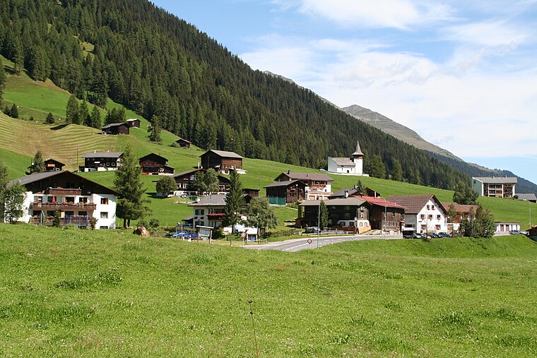
Photo: Parpan05, CC BY-SA 3.0.
Davos Frauenkirch is a hamlet, which is situated 9 km west of Discgolf Davos.
Discgolf Davos
- Type: Disc golf course
- Categories: recreation area and sports location
- Location: Davos, Region Prättigau / Davos, Graubünden, Switzerland, Central Europe, Europe
- View on OpenStreetMap
Latitude
46.78682° or 46° 47′ 13″ northLongitude
9.92019° or 9° 55′ 13″ eastOpen location code
8FRFQWPC+P3OpenStreetMap ID
node 11328903843OpenStreetMap feature
leisure=disc_golf_course
This page is based on OpenStreetMap, Wikidata, and Wikimedia Commons.
We’d love your help improving our open data sources. Thank you for contributing.
Satellite Map
Discover Discgolf Davos from above in high-definition satellite imagery.
Notable Places Nearby
Highlights include Tschuggen Kapelle and Baslersch Chopf (Wintergipfel).
Nearby Places
Explore places such as Gasthaus zum Tschuggen and Tschuggen.
Graubünden: Must-Visit Destinations
Delve into Chur, St. Moritz, Arosa, and Klosters.
Curious Disc Golf Courses to Discover
Uncover intriguing disc golf courses from every corner of the globe.
About Mapcarta. Data © OpenStreetMap contributors and available under the Open Database License". Text is available under the CC BY-SA 4.0 license, except for photos, directions, and the map. Photo: Flyout, CC BY-SA 3.0.