Campina do Arruda
Campina do Arruda is a suburb in Almirante Tamandaré, Paraná. Campina do Arruda is situated nearby to the suburb Roça Grande, as well as near Cachoeira.| Tap on a place to explore it |
Places in the Area
Nearby places include Colombo and Civic Center.
Colombo

Photo: SamirNosteb, CC BY 3.0.
Colombo is a 247,000 inhabitants in Grande Curitiba. Colombo has a strong appeal for rural tourism. The region is geographically rich, has beautiful landscapes and also has the cultural heritage of Italian immigrants.
Civic Center
Suburb
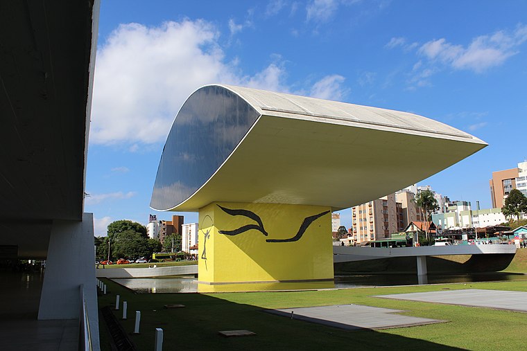
Photo: Cassia Naomi Nakai, CC BY-SA 4.0.
Curitiba is the capital and largest city in the state of Paraná in Southern Brazil. The city's population was 1,829,225 as of 2024, making it the eighth most populous city in Brazil and the largest in Brazil's South Region. Civic Center is situated 8 km south of Campina do Arruda.
Curitiba Historical Centre
Neighborhood

Photo: KikoCorreia, CC BY-SA 2.5 br.
Curitiba Historical Centre is a neighborhood, which is situated 10 km south of Campina do Arruda.
Campina do Arruda
- Type: Suburb
- Category: locality
- Location: Almirante Tamandaré, Paraná, South, Brazil, South America
- View on OpenStreetMap
Latitude
-25.3446° or 25° 20′ 41″ southLongitude
-49.24242° or 49° 14′ 33″ westOpen location code
586GMQ45+52OpenStreetMap ID
node 11335961932OpenStreetMap feature
place=suburb
This page is based on OpenStreetMap, Wikidata, and Wikimedia Commons.
We’d love your help improving our open data sources. Thank you for contributing.
Satellite Map
Discover Campina do Arruda from above in high-definition satellite imagery.
Localities in the Area
Explore places such as Roça Grande and Cachoeira.
Notable Places Nearby
Highlights include Chica Veia and Campinho.
Paraná: Must-Visit Destinations
Delve into Curitiba, Londrina, Foz do Iguaçu, and Maringá.
Curious Suburbs to Discover
Uncover intriguing suburbs from every corner of the globe.
About Mapcarta. Data © OpenStreetMap contributors and available under the Open Database License". Text is available under the CC BY-SA 4.0 license, except for photos, directions, and the map. Photo: S23678, CC BY 3.0.