Bivak Špica
Bivak Špica is a shelter in Municipality of Žalec, Slovenia. Bivak Špica is situated nearby to the peak Gora (Špica), as well as near Brezje.| Tap on a place to explore it |
Places of Interest Nearby
Highlights include Red Hall and Šalek Castle.
Red Hall
Sports venue
Red Hall is a sports facility arena in Velenje, Slovenia. It is the home arena of handball club Gorenje Velenje. The venue can accommodate 2,500 spectators. Red Hall is situated 3½ km northwest of Bivak Špica.
Šalek Castle
Ruins
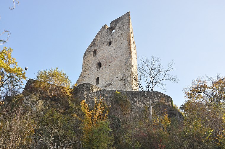
Photo: Wikimedia, CC BY-SA 4.0.
Šalek Castle is a ruins, which is situated 3½ km northwest of Bivak Špica.
Ekenštajn Castle
Ruins

Photo: Georg Matthäus Vischer, Public domain.
Ekenštajn Castle is a ruins, which is situated 3 km northwest of Bivak Špica.
Places in the Area
Nearby places include Vinska Gora and Ponikva pri Žalcu.
Vinska Gora
Village

Photo: Sl-Ziga, CC BY-SA 3.0.
Vinska Gora is a village in the Municipality of Velenje in northern Slovenia. The area is part of the traditional region of Styria. The entire municipality is now included in the Savinja Statistical Region.
Ponikva pri Žalcu
Village

Photo: Sl-Ziga, CC BY-SA 3.0.
Ponikva pri Žalcu is a village in the Municipality of Žalec in east-central Slovenia. It lies in the Ložnica Hills northwest of Žalec. The area is part of the traditional region of Styria. The municipality is now included in the Savinja Statistical Region.
Arnače
Village

Photo: Sl-Ziga, CC BY-SA 3.0.
Arnače is a village in the Municipality of Velenje in northern Slovenia. It lies in the Ložnica Hills south of the town of Velenje. The area is part of the traditional region of Styria. The entire municipality is now included in the Savinja Statistical Region. Arnače is situated 2½ km west of Bivak Špica.
Bivak Špica
- Type: Shelter
- Location: Municipality of Žalec, Slovenia, Central Europe, Europe
- View on OpenStreetMap
Latitude
46.33322° or 46° 19′ 60″ northLongitude
15.1479° or 15° 8′ 53″ eastOpen location code
8FRQ84MX+75OpenStreetMap ID
node 11341878249OpenStreetMap feature
amenity=shelter
This page is based on OpenStreetMap, Wikidata, and Wikimedia Commons.
We’d love your help improving our open data sources. Thank you for contributing.
Satellite Map
Discover Bivak Špica from above in high-definition satellite imagery.
Notable Places Nearby
Highlights include Gora (Špica) and Brezje.
Nearby Places
Explore places such as Sp. Laze 2 and Sp. Laze 3.
Slovenia: Must-Visit Destinations
Delve into Ljubljana, Maribor, Koper, and Celje.
Curious Shelters to Discover
Uncover intriguing shelters from every corner of the globe.
About Mapcarta. Data © OpenStreetMap contributors and available under the Open Database License". Text is available under the CC BY-SA 4.0 license, except for photos, directions, and the map. Photo: Jjtkk, CC BY 3.0.