Bittersweet Candy
Bittersweet Candy is a confectionery in City of Schenectady, New York which is located on Jay Street. Bittersweet Candy is situated nearby to the government office Schenectady Metroplex Development Authority, as well as near the neighborhood Downtown Schenectady.| Tap on a place to explore it |
Places of Interest Nearby
Highlights include Proctor’s Theatre and Schenectady station.
Proctor’s Theatre
Theater building

Photo: UpstateNYer, CC BY-SA 3.0.
Proctor's Theatre is a theatre and former vaudeville house located in Schenectady, New York, United States. Many famous artists have performed there, including Mariah Carey, Britney Spears, Hal Holbrook, Ted Wiles, and George Burns, as well as many others. Proctor’s Theatre is situated 470 feet southwest of Bittersweet Candy.
Schenectady station
Railway station
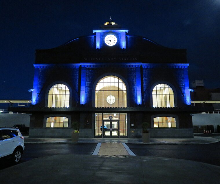
Photo: Bjturon, CC BY-SA 4.0.
Schenectady station is an Amtrak intercity train station in Schenectady, New York. The station, constructed in 2018 is owned by the Capital District Transportation Authority which also owns Albany–Rensselaer station and Saratoga Springs station. Schenectady station is situated 780 feet northwest of Bittersweet Candy.
Schenectady City Hall
Town hall

Photo: Daniel Case, CC BY-SA 3.0.
Schenectady City Hall is the seat of government of the city of Schenectady, New York, United States. Designed by McKim, Mead, and White, the building was constructed between 1931 and 1933. Schenectady City Hall is situated 600 feet northeast of Bittersweet Candy.
Places in the Area
Nearby places include Downtown Schenectady and Schenectady.
Downtown Schenectady
Neighborhood

Photo: Wikimedia, CC BY-SA 2.0.
Downtown Schenectady is the central business district for the city of Schenectady, New York. It originated in the 1820s with the moving of the commercial and industrial interests east from the original 17th and 18th century settlement, spurred on by the development of the Erie Canal.
Schenectady

Photo: UpstateNYer, CC BY-SA 3.0.
Schenectady, once called the city that lights and hauls the world, is in the Hudson Valley region of New York. Approximately 20 minutes from New York's capital of Albany, Schenectady is best known as the birthplace of General Electric and for Proctor's Theater.
Mont Pleasant
Neighborhood
Mont Pleasant is a neighborhood of Schenectady, New York, United States. It is located in the south central part of the city and is the most populated of Schenectady's neighborhoods and has the most housing units as well.
Bittersweet Candy
- Type: Confectionery
- Address: 173 Jay Street, Schenectady, NY 12305
- Categories: shop, workshop, and confectionery store
- Location: City of Schenectady, Schenectady, New York, Mid-Atlantic, United States, North America
- View on OpenStreetMap
Latitude
42.81286° or 42° 48′ 46″ northLongitude
-73.941° or 73° 56′ 28″ westOpen location code
87J8R375+4HOpenStreetMap ID
node 11346035275OpenStreetMap feature
craft=confectioneryOpenStreetMap feature
shop=confectionery
This page is based on OpenStreetMap, Wikidata, and Wikimedia Commons.
We’d love your help improving our open data sources. Thank you for contributing.
Satellite Map
Discover Bittersweet Candy from above in high-definition satellite imagery.
Notable Places Nearby
Highlights include Schenectady Metroplex Development Authority and UnBEETable.
Nearby Places
Explore places such as Herbie’s Burgers and Killeen Building.
New York: Must-Visit Destinations
Delve into New York City, Buffalo, Manhattan, and West Side.
Curious Confectioneries to Discover
Uncover intriguing confectioneries from every corner of the globe.
About Mapcarta. Data © OpenStreetMap contributors and available under the Open Database License". Text is available under the CC BY-SA 4.0 license, except for photos, directions, and the map. Photo: Jeffrey Johnson, CC BY-SA 2.0.