Hakkilankallio
Hakkilankallio is a peak in Vantaa, Helsinki sub-region, Uusimaa and has an elevation of 56 metres. Hakkilankallio is situated nearby to the suburb Kaskela (Vantaa), as well as near the locality Honkanummi.| Tap on a place to explore it |
Places of Interest
Highlights include Heureka and Helsinki Tikkurila Railway Station.
Heureka
Museum
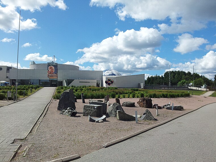
Photo: Danila Talikov, CC BY-SA 3.0.
Heureka is a science center in the Tikkurila district of Vantaa, Finland, north of Helsinki, designed by Heikkinen – Komonen Architects. It is located at the intersection of the Finnish Main Line and the river Keravanjoki.
Helsinki Tikkurila Railway Station
Railway station
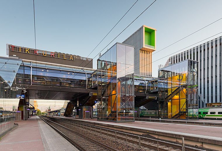 Tikkurila station is located in Tikkurila, the administrative centre of Vantaa in the Helsinki metropolitan area. It is located approximately 16 kilometres from Helsinki Central railway station and 5 kilometres from Helsinki Airport.

Places in the Area
Nearby places include Sipoonkorpi National Park and Suurmetsä.
Sipoonkorpi National Park

Photo: Ypsilon from Finland, CC0.
Sipoonkorpi National Park is in Uusimaa, one of two national parks reaching into the Capital Region.
Mellunkylä
Suburb
Mellunkylä is a neighbourhood in East Helsinki, Finland. The area of Mellunkylä is 9,9 km2 and it has population of 36,360. There are five suburbs in Mellunkylä: Mellunkylä had some suburban settlements already before World War II.
Hakkilankallio
- Type: Peak with an elevation of 56 metres
- Category: landform
- Location: Vantaa, Helsinki sub-region, Uusimaa, Southern Finland, Finland, Nordic countries, Europe
- View on OpenStreetMap
Latitude
60.2854° or 60° 17′ 8″ northLongitude
25.0911° or 25° 5′ 28″ eastElevation
56 metres (184 feet)Open location code
9GG773PR+5COpenStreetMap ID
node 11364881107OpenStreetMap feature
natural=peak
This page is based on OpenStreetMap, Wikidata, and Wikimedia Commons.
We’d love your help improving our open data sources. Thank you for contributing.
Satellite Map
Discover Hakkilankallio from above in high-definition satellite imagery.
Localities in the Area
Explore places such as Hakkilankallio and Kaskela (Vantaa).
Notable Places Nearby
Highlights include Liisanmetsikkö and Vantaa Prison.
Uusimaa: Must-Visit Destinations
Delve into Helsinki, Espoo, Porvoo, and Lohja.
Curious Peaks to Discover
Uncover intriguing peaks from every corner of the globe.
About Mapcarta. Data © OpenStreetMap contributors and available under the Open Database License". Text is available under the CC BY-SA 4.0 license, except for photos, directions, and the map. Photo: Wikimedia, CC0.