Lowther Avenue
Lowther Avenue is a bus stop in Old Toronto, Toronto, Ontario. Lowther Avenue is situated nearby to the church Religious Society of Friends, as well as near the fountain Vessel.| Tap on a place to explore it |
Places of Interest Nearby
Highlights include Royal Ontario Museum and Taddle Creek Park.
Royal Ontario Museum
Museum
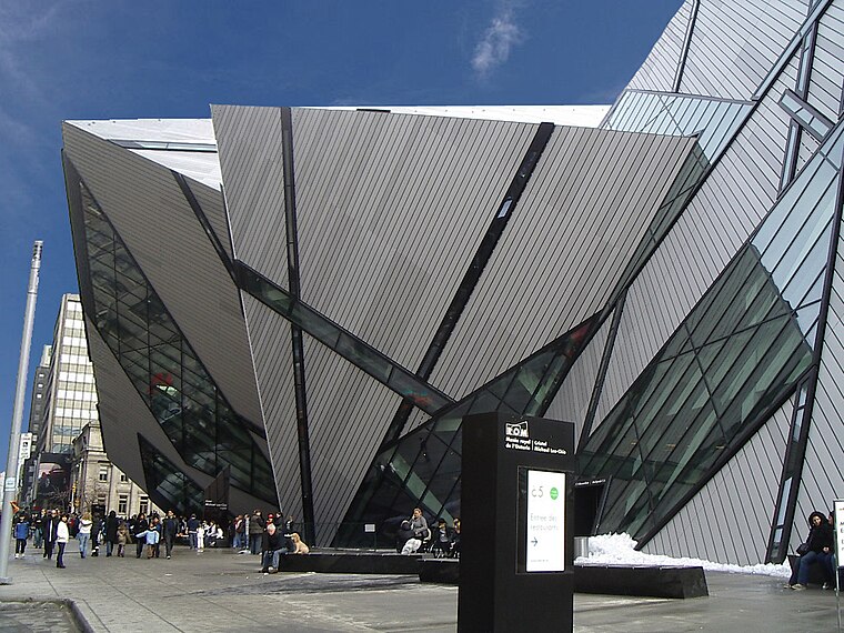
Photo: Staka, CC BY-SA 4.0.
The Royal Ontario Museum is a museum of art, world culture and natural history in Toronto, Ontario, Canada. It is one of the largest museums in North America and the largest in Canada. Royal Ontario Museum is situated 430 metres southeast of Lowther Avenue.
Taddle Creek Park
Park

Photo: Secondarywaltz, CC0.
Taddle Creek Park is a small but busy park at the southwest corner of Lowther Avenue and Bedford Road, in The Annex area of Toronto.
Bata Shoe Museum
Museum

Photo: Gisling, CC BY-SA 3.0.
The Bata Shoe Museum is a museum of footwear and calceology in Toronto, Ontario, Canada. The museum's building is situated near the northwest of the University of Toronto St. Bata Shoe Museum is situated 380 metres south of Lowther Avenue.
Places in the Area
Nearby places include Yorkville and the Annex and Yorkville.
Yorkville and the Annex

Photo: Daniel MacDonald, CC BY 2.0.
Yorkville and The Annex are two neighbourhoods along Bloor St where downtown Toronto meets midtown. Helped by the University of Toronto and the stately homes in the area, the district has a different feel than the downtown neighbourhoods to the south with their modern condos and busier lifestyles.
Yorkville
Neighborhood

Photo: Haaron755, CC BY-SA 3.0.
Yorkville is a neighbourhood and former village in Toronto, Ontario, Canada. It is roughly bounded by Bloor Street to the south, Davenport Road to the north, Yonge Street to the east and Avenue Road to the west, and it is part of the Annex neighbourhood.
Casa Loma
Neighborhood

Photo: GTD Aquitaine, Public domain.
Casa Loma is a neighbourhood in the city of Toronto in Ontario, Canada, and is named after the famous castle. It is bounded on the north by St. Clair Avenue West, on the east by Spadina Road, on the south by the CP railway tracks, and on the west by Bathurst Street.
Lowther Avenue
- Type: Bus stop
- Wheelchair access: yes
- Category: transportation
- Location: Old Toronto, Toronto, Greater Toronto Area, Ontario, Canada, North America
- View on OpenStreetMap
Latitude
43.67041° or 43° 40′ 14″ northLongitude
-79.39845° or 79° 23′ 54″ westOperator
Toronto Transit CommissionOpen location code
87M2MJC2+5JOpenStreetMap ID
node 1136589881OpenStreetMap feature
highway=bus_stopOpenStreetMap feature
public_transport=platformOpenStreetMap attribute
wheelchair=yes
This page is based on OpenStreetMap, Wikidata, and Wikimedia Commons.
We’d love your help improving our open data sources. Thank you for contributing.
Satellite Map
Discover Lowther Avenue from above in high-definition satellite imagery.
Places with the Same Name
Discover other places named “Lowther Avenue”.
Notable Places Nearby
Highlights include Religious Society of Friends and Vessel.
Nearby Places
Explore places such as Lowther Avenue and Taddle Creek Park.
Toronto: Must-Visit Destinations
Delve into Yorkville and the Annex, Midtown, East End, and Downtown East.
Curious Bus Stops to Discover
Uncover intriguing bus stops from every corner of the globe.
About Mapcarta. Data © OpenStreetMap contributors and available under the Open Database License". Text is available under the CC BY-SA 4.0 license, except for photos, directions, and the map. Photo: S23678, CC BY-SA 3.0.