Ferienwohnungen ‘Mühle’
Ferienwohnungen ‘Mühle’ is an apartment in Suhl, Thuringia which is located on Zum Zimmergrund. Ferienwohnungen ‘Mühle’ is situated nearby to Protestant Church Albrechts, as well as near the fire station Freiwillige Feuerwehr Suhl-Albrechts.| Tap on a place to explore it |
Places of Interest Nearby
Highlights include Protestant Church Albrechts and Talbrücke Albrechtsgraben.
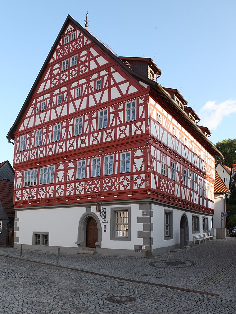
Protestant Church Albrechts
Church

Photo: Störfix, CC BY-SA 3.0 de.
Protestant Church Albrechts is situated 140 metres south of Ferienwohnungen ‘Mühle’.
Talbrücke Albrechtsgraben
Bridge

Photo: Störfix, CC BY-SA 3.0.
Talbrücke Albrechtsgraben is a bridge, which is situated 1 km southwest of Ferienwohnungen ‘Mühle’.
Protestant Church Mäbendorf
Church

Photo: Störfix, CC BY-SA 3.0 de.
Protestant Church Mäbendorf is situated 2 km southwest of Ferienwohnungen ‘Mühle’.
Places in the Area
Nearby places include Albrechts and Mäbendorf.

Ferienwohnungen ‘Mühle’
- Type: Apartment
- Address: Zum Zimmergrund 20, Suhl, 98529
- Categories: tourism, accommodation, and building
- Location: Suhl, Thuringia, Germany, Central Europe, Europe
- View on OpenStreetMap
Latitude
50.61906° or 50° 37′ 9″ northLongitude
10.64218° or 10° 38′ 32″ eastOpen location code
9F2GJJ9R+JVOpenStreetMap ID
node 11368173845OpenStreetMap feature
tourism=apartment
This page is based on OpenStreetMap, Wikidata, and Wikimedia Commons.
We’d love your help improving our open data sources. Thank you for contributing.
Satellite Map
Discover Ferienwohnungen ‘Mühle’ from above in high-definition satellite imagery.
Notable Places Nearby
Highlights include Freiwillige Feuerwehr Suhl-Albrechts and Waldspielplatz Albrechts.
Nearby Places
Explore places such as Döner & Pizza Haus and Dr. med. Margret Siering.
Curious Apartments to Discover
Uncover intriguing apartments from every corner of the globe.
About Mapcarta. Data © OpenStreetMap contributors and available under the Open Database License". Text is available under the CC BY-SA 4.0 license, except for photos, directions, and the map. Photo: A.Savin, FAL.