La Haute Caillouais
La Haute Caillouais is a hamlet in Boisgervilly, Arrondissement of Rennes, Brittany. La Haute Caillouais is situated nearby to the hamlet La Caillouais, as well as near La Ville Danet.| Tap on a place to explore it |
Places of Interest
Highlights include Montauban-de-Bretagne Station and Église Sainte-Trinité.


Places in the Area
Nearby places include Iffendic and La Nouaye.
Iffendic

Photo: Office de tourisme d…, CC BY 3.0.
Iffendic is a commune in the department of Ille-et-Vilaine in Brittany. The Meu River goes through the town. It is 20 km from Rennes and is surrounded by Montfort-sur-Meu, Bédée, La Nouaye, Breteil, Pleumeleuc, Talensac, Saint-Gonlay.
La Nouaye
 La Nouaye is a commune in the department of Ille-et-Vilaine in Brittany. The commune of La Nouaye is part of Montfort-sur-Meu county. It comes under the control of Rennes.
Saint-Gonlay
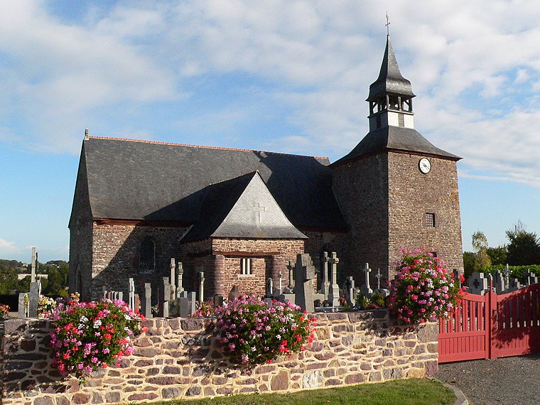
Photo: Floranne2006, CC BY-SA 3.0.
Saint-Gonlay is a commune in the department of Ille-et-Vilaine in Brittany. The Meu river goes through the town. There are 280 inhabitants in Saint-Gonlay and the territory stretches over 926 hectares.
La Haute Caillouais
- Type: Hamlet
- Category: locality
- Location: Boisgervilly, Arrondissement of Rennes, Ille-et-Vilaine, Brittany, France, Europe
- View on OpenStreetMap
Latitude
48.17845° or 48° 10′ 42″ northLongitude
-2.06378° or 2° 3′ 50″ westOpen location code
8CWV5WHP+9FOpenStreetMap ID
node 11384185839OpenStreetMap feature
place=hamlet
This page is based on OpenStreetMap, Wikidata, and Wikimedia Commons.
We’d love your help improving our open data sources. Thank you for contributing.
Satellite Map
Discover La Haute Caillouais from above in high-definition satellite imagery.
Localities in the Area
Explore places such as La Caillouais and La Ville Danet.
Notable Places Nearby
Highlights include Boisgervilly and Mairie de Boisgervilly.
Brittany: Must-Visit Destinations
Delve into Rennes, Brest, Finistère, and Morbihan.
Curious Hamlets to Discover
Uncover intriguing hamlets from every corner of the globe.
About Mapcarta. Data © OpenStreetMap contributors and available under the Open Database License". Text is available under the CC BY-SA 4.0 license, except for photos, directions, and the map. Photo: Spendeau, CC BY-SA 3.0.