nsi Food Pantry
nsi Food Pantry is a social service facility in City of Columbus, Franklin, Ohio. nsi Food Pantry is situated nearby to Suzi-Cue Pool Hall, as well as near Dwell Community Church - 4th Street.| Tap on a place to explore it |
Places of Interest Nearby
Highlights include Wexner Center for the Arts and Taft Coliseum.
Wexner Center for the Arts
Arts center
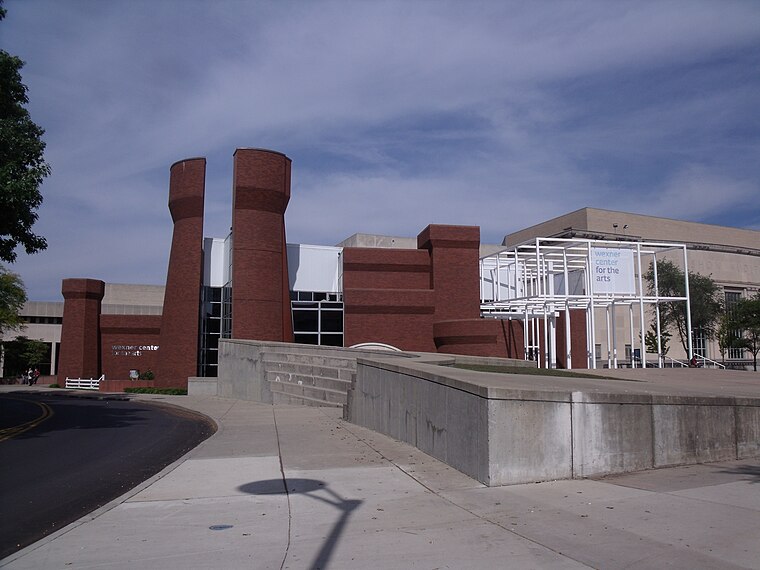
Photo: Ibagli, Public domain.
The Wexner Center for the Arts is the Ohio State University's "multidisciplinary, international laboratory for the exploration and advancement of contemporary art." The Wexner Center is a lab and public gallery, but not an art museum, as it does not collect art. Wexner Center for the Arts is situated 3,300 feet west of nsi Food Pantry.
Taft Coliseum
The Taft Coliseum is a 5,003-permanent seat multi-purpose arena located at the Ohio Expo Center and State Fairgrounds in Columbus, Ohio. Taft Coliseum is situated 2,300 feet southeast of nsi Food Pantry.Ohio Expo Center and State Fairgrounds
The Ohio Expo Center and State Fairgrounds is an exhibition center and fairground site, located in Columbus, Ohio. The site has been home to the Ohio State Fair since 1886. Ohio Expo Center and State Fairgrounds is situated 2,500 feet southeast of nsi Food Pantry.Places in the Area
Nearby places include University Area and Northwood Park.
University Area
 University Area also known as the University District is the area around the Ohio State University in Columbus, Ohio. It also includes the OSU Hospital and The James Cancer Research Hospital.
Northwood Park
Neighborhood
The Oakland & Northwood Avenue Area is located in the northern University District in Columbus, Ohio and is bounded by Patterson Avenue to the north and Northwood Avenue to the south & Pearl Alley to the west and Indianola Avenue to the east.
Weinland Park
Quarter

Photo: Carvalho.26, CC BY-SA 4.0.
Weinland Park is a neighborhood north of downtown Columbus, Ohio and encompassed by the boundaries of the University District. A development boom in the 1930s and 1940s resulting from new streetcar lines and the blossoming of factories brought working and middle-class families to the neighborhood.
nsi Food Pantry
- Type: Social service facility
- Location: City of Columbus, Franklin, Ohio, Midwest, United States, North America
- View on OpenStreetMap
Latitude
40.00294° or 40° 0′ 11″ northLongitude
-82.99808° or 82° 59′ 53″ westOpen location code
86GV2232+5QOpenStreetMap ID
node 11392722260OpenStreetMap feature
amenity=social_facility
This page is based on OpenStreetMap, Wikidata, and Wikimedia Commons.
We’d love your help improving our open data sources. Thank you for contributing.
Satellite Map
Discover nsi Food Pantry from above in high-definition satellite imagery.
Notable Places Nearby
Highlights include Suzi-Cue Pool Hall and Dwell Community Church - 4th Street.
Nearby Places
Explore places such as Indianola Shopping Center and King’s.
Ohio: Must-Visit Destinations
Delve into Columbus, Cincinnati, Cleveland, and Bowling Green.
Curious Social Service Facilities to Discover
Uncover intriguing social service facilities from every corner of the globe.
About Mapcarta. Data © OpenStreetMap contributors and available under the Open Database License". Text is available under the CC BY-SA 4.0 license, except for photos, directions, and the map. Photo: Wikimedia, CC0.