Albert the Alligator
Albert the Alligator is a work of art in Beaufort County, South Carolina. Albert the Alligator is situated nearby to the fire station Hilton Head Island Fire / Rescue Station 2.| Tap on a place to explore it |
Places of Interest Nearby
Highlights include Harbour Town Light.
Harbour Town Light
Lighthouse
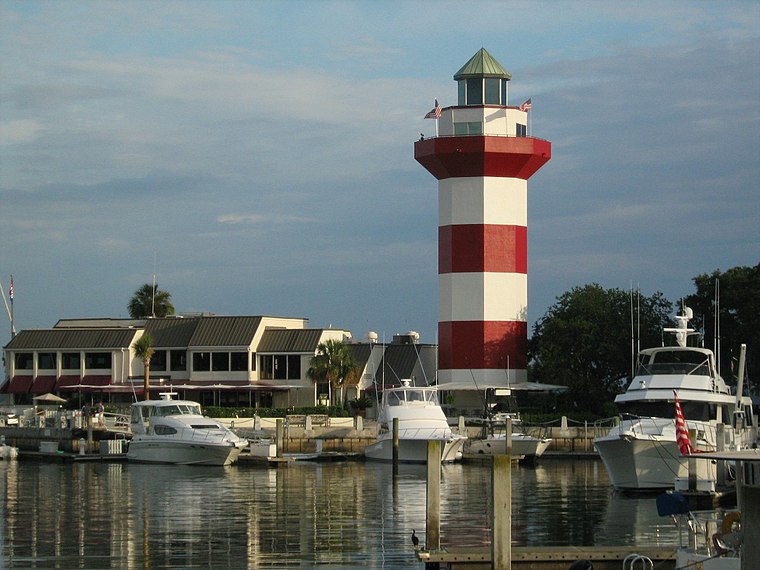
Photo: MoodyGroove, CC BY-SA 3.0.
The Harbour Town Lighthouse is a lighthouse at the Harbour Town Marina at Hilton Head Island, South Carolina built between 1969 and 1970. It was privately built and is a private aid to navigation. Harbour Town Light is situated 1½ miles northwest of Albert the Alligator.
Places in the Area
Nearby places include Hilton Head Island.
Hilton Head Island

Photo: fw gadget, CC BY-SA 2.0.
Hilton Head Island is a city and barrier island in South Carolina, just across the border from Savannah, Georgia. With an approximate population of 40,000, it is on a beautiful, sub-tropical 12-mile barrier island.
Albert the Alligator
- Type: Work of art
- Artwork type: statue
- Category: tourism
- Location: Beaufort County, South Carolina, South, United States, North America
- View on OpenStreetMap
Latitude
32.12767° or 32° 7′ 40″ northLongitude
-80.78971° or 80° 47′ 23″ westOpen location code
864X46H6+34OpenStreetMap ID
node 11403800811OpenStreetMap feature
tourism=artworkOpenStreetMap attribute
artwork_type=statue
This page is based on OpenStreetMap, Wikidata, and Wikimedia Commons.
We’d love your help improving our open data sources. Thank you for contributing.
Satellite Map
Discover Albert the Alligator from above in high-definition satellite imagery.
Notable Places Nearby
Highlights include Hilton Head Island Fire / Rescue Station 2 and Sea Pines Community Center.
Nearby Places
Explore places such as Plantation Golf Club and Fraser’s Tavern.
South Carolina: Must-Visit Destinations
Delve into Columbia, Charleston, Greenville, and Myrtle Beach.
Curious Work Of Arts to Discover
Uncover intriguing work of arts from every corner of the globe.
About Mapcarta. Data © OpenStreetMap contributors and available under the Open Database License". Text is available under the CC BY-SA 4.0 license, except for photos, directions, and the map. Photo: Rastapopulous, CC BY-SA 3.0.