Radstation Vegesack
Radstation Vegesack is a bicycle parking in Bremen, Germany which is located on Vegesacker Bahnhofsplatz. Radstation Vegesack is situated nearby to Station building, as well as near the tourism office BSAG-Kundencenter Vegesack.| Tap on a place to explore it |
Places of Interest Nearby
Highlights include Bremen-Vegesack station and Vegesacker Hafen.
Bremen-Vegesack station
Railway station
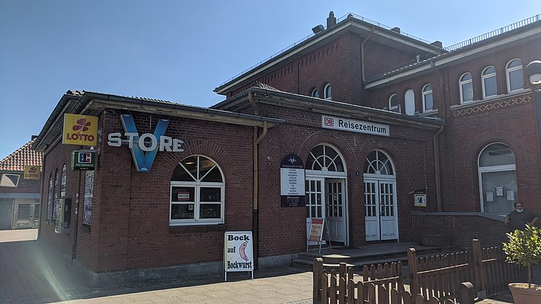
Photo: Clic, CC BY-SA 4.0.
Bremen-Vegesack is a railway station serving the Vegesack district of Bremen. The station is part of the Bremen-Farge railway line served by Bremen S-Bahn line RS1, operated by NordWestBahn. Bremen-Vegesack station is situated 110 metres northeast of Radstation Vegesack.
Vegesacker Hafen
Marina

Photo: Thpohl, Public domain.
Vegesacker Hafen is a marina, which is situated 140 metres west of Radstation Vegesack.
Löschboot 1

Photo: Ein Dahmer, CC BY-SA 4.0.
Löschboot 1 is situated 150 metres southwest of Radstation Vegesack.
Places in the Area
Nearby places include Grohner Düne and Bremen-Vegesack.

Bremen-Vegesack
Suburb

Photo: Dtuk, CC BY-SA 3.0.
Vegesack is a northern district of Bremen, the capital of the German state Free Hanseatic City of Bremen.
Lemwerder
Town

Photo: Traveler100, CC BY-SA 3.0.
Lemwerder is a municipality in the district of Wesermarsch, in Lower Saxony, Germany. It is on the left bank of the Weser, approximately 27 kilometres east of Oldenburg, and 17 kilometres northwest of the centre of Bremen.
Radstation Vegesack
- Type: Bicycle parking
- Address: Vegesacker Bahnhofsplatz, Bremen, 28757
- Category: transportation
- Location: Bremen, City state Bremen, Germany, Central Europe, Europe
- View on OpenStreetMap
Latitude
53.16929° or 53° 10′ 9″ northLongitude
8.62858° or 8° 37′ 43″ eastOperator
ADFCOpen location code
9F5C5J9H+PCOpenStreetMap ID
node 1141481049OpenStreetMap feature
amenity=bicycle_parking
This page is based on OpenStreetMap, Wikidata, and Wikimedia Commons.
We’d love your help improving our open data sources. Thank you for contributing.
Satellite Map
Discover Radstation Vegesack from above in high-definition satellite imagery.
Notable Places Nearby
Highlights include Station building and BSAG-Kundencenter Vegesack.
Nearby Places
Explore places such as Hafen Kiosk 24/7 and Bahnhof Vegesack.
Germany: Must-Visit Destinations
Delve into Berlin, Munich, Hamburg, and Frankfurt.
Curious Bicycle Parkings to Discover
Uncover intriguing bicycle parkings from every corner of the globe.
About Mapcarta. Data © OpenStreetMap contributors and available under the Open Database License". Text is available under the CC BY-SA 4.0 license, except for photos, directions, and the map. Photo: Dschwen, CC BY-SA 3.0.