1789_Velo_Delandine_SN
1789_Velo_Delandine_SN is a monitoring station in Lyon, Greater Lyon, Auvergne-Rhône-Alpes. 1789_Velo_Delandine_SN is situated nearby to the restaurant Brasserie Georges, as well as near the arts center Le Périscope.| Tap on a place to explore it |
Places of Interest Nearby
Highlights include Gare de Lyon-Perrache and Brasserie Georges.
Gare de Lyon-Perrache
Railway station
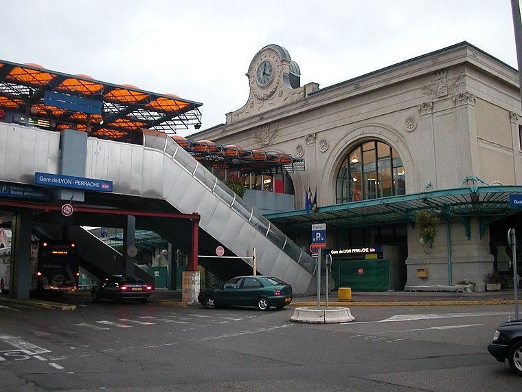
Photo: Pymouss44, CC BY-SA 3.0.
Lyon–Perrache or simply Perrache is a large railway station located in the Perrache quarter, in the 2nd arrondissement of Lyon, France. Historically the primary railway station in Lyon, today it is the city's second-busiest station, after the newer Lyon-Part-Dieu station. Gare de Lyon-Perrache is situated 240 metres west of 1789_Velo_Delandine_SN.
Brasserie Georges
Restaurant

Photo: Prométhée33, CC BY-SA 3.0.
The Brasserie Georges is a restaurant located in the 2nd arrondissement of Lyon. It is the oldest brasserie in the city and one of the largest brasseries in Europe.
Perrache hanging gardens
Park

Photo: Rexcornot, CC BY-SA 4.0.
Perrache hanging gardens is a park, which is situated 160 metres north of 1789_Velo_Delandine_SN.
Places in the Area
Nearby places include 2nd arrondissement of Lyon and La Confluence.
2nd arrondissement of Lyon
Suburb

Photo: Romainbehar, CC0.
The 2nd arrondissement of Lyon is one of the nine arrondissements of the City of Lyon.

Saint-Georges Neighbourhood in Lyon
Neighborhood

Photo: Peter17, CC BY-SA 4.0.
Saint-Georges Neighbourhood in Lyon is a neighborhood.
1789_Velo_Delandine_SN
- Type: Monitoring station
- Location: Lyon, Arrondissement of Lyon, Greater Lyon, Auvergne-Rhône-Alpes, France, Europe
- View on OpenStreetMap
Latitude
45.74797° or 45° 44′ 53″ northLongitude
4.82832° or 4° 49′ 42″ eastOpen location code
8FQ6PRXH+58OpenStreetMap ID
node 11425572380OpenStreetMap feature
man_made=monitoring_station
This page is based on OpenStreetMap, Wikidata, and Wikimedia Commons.
We’d love your help improving our open data sources. Thank you for contributing.
Satellite Map
Discover 1789_Velo_Delandine_SN from above in high-definition satellite imagery.
Notable Places Nearby
Highlights include Le Périscope and Bibliothèque universitaire Henri de Lubac - Campus Saint-Paul.
Nearby Places
Explore places such as Résidence Orfea Lyon Perrache and 1790_Velo_Delandine_NS.
Greater Lyon: Must-Visit Destinations
Delve into Saint-Étienne, Roanne, Villefranche-sur-Saône, and Divonne-les-Bains.
Curious Monitoring Stations to Discover
Uncover intriguing monitoring stations from every corner of the globe.
About Mapcarta. Data © OpenStreetMap contributors and available under the Open Database License". Text is available under the CC BY-SA 4.0 license, except for photos, directions, and the map. Photo: Fabimaru, CC0.