Suhl-Heinrichs
Suhl-Heinrichs is a railway stop in Suhl, Thuringia. Suhl-Heinrichs is situated nearby to the church Königreichssaal Jehovas Zeugen, as well as near the peak Vorderer Haak.| Tap on a place to explore it |
Places of Interest Nearby
Highlights include Protestant Church Mäbendorf and Talbrücke Albrechtsgraben.
Protestant Church Mäbendorf
Church

Photo: Störfix, CC BY-SA 3.0 de.
Protestant Church Mäbendorf is situated 760 metres west of Suhl-Heinrichs.
Talbrücke Albrechtsgraben
Bridge

Photo: Störfix, CC BY-SA 3.0.
Talbrücke Albrechtsgraben is a bridge, which is situated 1 km north of Suhl-Heinrichs.
Rathaus Heinrichs
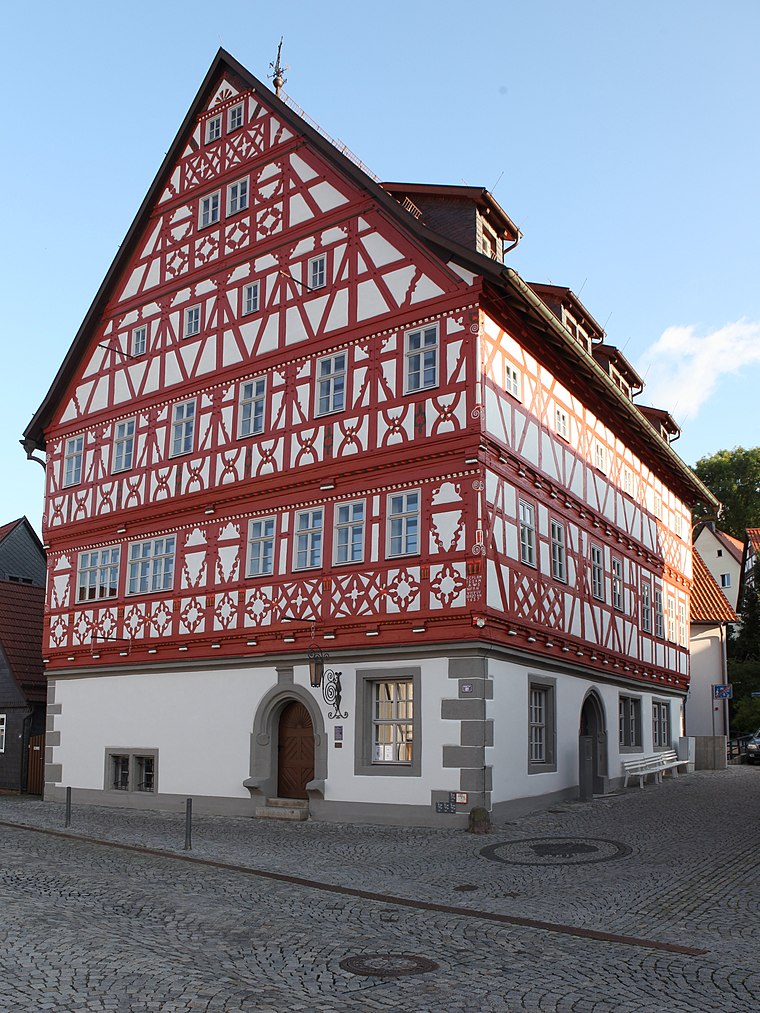
Photo: Störfix, CC BY-SA 3.0 de.
Rathaus Heinrichs is situated 1¼ km east of Suhl-Heinrichs.
Places in the Area
Nearby places include Mäbendorf and Heinrichs.

Suhl-Heinrichs
- Type: Railway stop
- Categories: railway station, station, and transportation
- Location: Suhl, Thuringia, Germany, Central Europe, Europe
- View on OpenStreetMap
Latitude
50.60217° or 50° 36′ 8″ northLongitude
10.63757° or 10° 38′ 15″ eastElevation
395 metres (1,296 feet)Operator
DB Station&Service AGOpen location code
9F2GJJ2Q+V2OpenStreetMap ID
node 11426103698OpenStreetMap feature
public_transport=stationOpenStreetMap feature
railway=halt
This page is based on OpenStreetMap, Wikidata, and Wikimedia Commons.
We’d love your help improving our open data sources. Thank you for contributing.
Satellite Map
Discover Suhl-Heinrichs from above in high-definition satellite imagery.
Notable Places Nearby
Highlights include Königreichssaal Jehovas Zeugen and Vorderer Haak.
Nearby Places
Explore places such as Suhl-Heinrichs and Autohaus Rolf Geißenhöner GmbH.
Curious Railway Stops to Discover
Uncover intriguing railway stops from every corner of the globe.
About Mapcarta. Data © OpenStreetMap contributors and available under the Open Database License". Text is available under the CC BY-SA 4.0 license, except for photos, directions, and the map. Photo: A.Savin, FAL.