Vine Trailhead
Vine Trailhead is in Town of Northfield, Franklin, Massachusetts. Vine Trailhead is situated nearby to the fire station Northfield Fire Department, as well as near Northfield Baptist Church.| Tap on a place to explore it |
Places of Interest Nearby
Highlights include Northfield Center Cemetery and Bennett’s Meadow Bridge.
Northfield Center Cemetery
Cemetery

Photo: Magicpiano, CC BY-SA 4.0.
The Northfield Center Cemetery is a historic cemetery located at the western terminus of Parker Avenue in Northfield, Massachusetts. Established in 1686, it is the town's first burying ground, with documented graves dating to 1714. Northfield Center Cemetery is situated 3,700 feet west of Vine Trailhead.
Bennett’s Meadow Bridge
Bridge
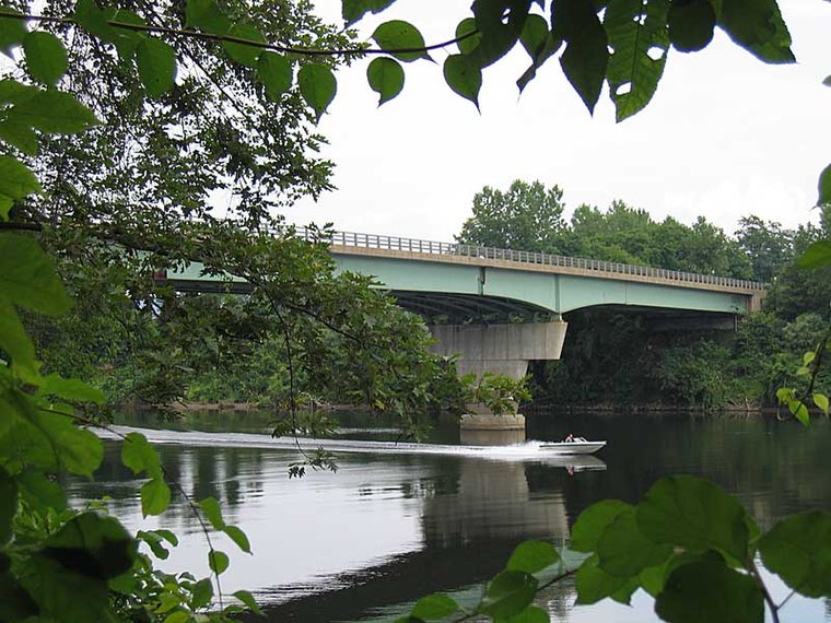
Photo: Denimadept, CC BY-SA 3.0.
The Route 10 bridge, also known as Bennett's Meadow Bridge is a 215.5-metre steel stringer bridge crossing the Connecticut River in the town of Northfield, Massachusetts. The bridge carries state highway Route 10 and was built in 1969. Bennett’s Meadow Bridge is situated 1½ miles southwest of Vine Trailhead.
West Northfield Cemetery
Cemetery

Photo: Faolin42, CC BY-SA 3.0.
West Northfield Cemetery is situated 1½ miles northwest of Vine Trailhead.
Places in the Area
Nearby places include Northfield and Gill.
Northfield
Town

Photo: Faolin42, CC BY-SA 3.0.
Northfield is a town in Franklin County, Massachusetts, United States. Northfield was first settled in 1673. The population was 2,866 at the 2020 census.
Gill

Photo: Denimadept, CC BY-SA 3.0.
Gill is a town in Franklin County, Massachusetts, United States. The population was 1,551 at the 2020 census. It is part of the Springfield, Massachusetts Metropolitan Statistical Area.
Bernardston
Village

Photo: ToddC4176, CC BY-SA 3.0.
Bernardston is a town in Franklin County, Massachusetts, United States. The population was 2,102 at the 2020 census. It is part of the Springfield, Massachusetts Metropolitan Statistical Area. Bernardston is situated 5 miles west of Vine Trailhead.
Vine Trailhead
- Type: Sign
- Categories: information and tourism
- Location: Town of Northfield, Franklin, Massachusetts, New England, United States, North America
- View on OpenStreetMap
Latitude
42.69528° or 42° 41′ 43″ northLongitude
-72.44724° or 72° 26′ 50″ westOpen location code
87J9MHW3+44OpenStreetMap ID
node 11438156943OpenStreetMap feature
tourism=information
This page is based on OpenStreetMap, Wikidata, and Wikimedia Commons.
We’d love your help improving our open data sources. Thank you for contributing.
Satellite Map
Discover Vine Trailhead from above in high-definition satellite imagery.
Notable Places Nearby
Highlights include Northfield Fire Department and Northfield Baptist Church.
Nearby Places
Explore places such as Sunshine Trailhead and Sunshine Trail.
Massachusetts: Must-Visit Destinations
Delve into Boston, Cambridge, Springfield, and Downtown Boston.
Curious Places to Discover
Uncover intriguing places from every corner of the globe.
About Mapcarta. Data © OpenStreetMap contributors and available under the Open Database License". Text is available under the CC BY-SA 4.0 license, except for photos, directions, and the map. Photo: Wikimedia, CC0.