Pau Pau Pavilion 2
Pau Pau Pavilion 2 is a shelter in Saipan, Northern Mariana Islands. Pau Pau Pavilion 2 is situated nearby to Pau Pau Beach, as well as near the helipad Nikko heliport.| Tap on a place to explore it |
Places in the Area
Nearby places include Tanapag and Capitol Hill.
Tanapag
Suburb
Tanapag is a settlement on the island of Saipan in the Northern Mariana Islands. It is located close to Tanapag Beach on the northwest coast, just to the north of Capital Hill, the island group's center of government. Tanapag is situated 2 miles southwest of Pau Pau Pavilion 2.
Capitol Hill
Village
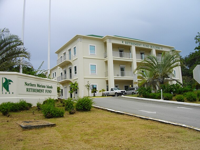
Photo: あばさー, Public domain.
Capitol Hill is a settlement on the island of Saipan in the Northern Mariana Islands. It has a population of around 1,000. Capitol Hill has been the territory's seat of government since 1962. Capitol Hill is situated 3½ miles southwest of Pau Pau Pavilion 2.
Kagman
Suburb
Kagman is a settlement on the island of Saipan in the Northern Mariana Islands. Kagman is situated 6 miles south of Pau Pau Pavilion 2.
Pau Pau Pavilion 2
- Type: Shelter
- Location: Saipan, Northern Mariana Islands, Micronesia, Oceania
- View on OpenStreetMap
Latitude
15.25538° or 15° 15′ 19″ northLongitude
145.78018° or 145° 46′ 49″ eastOperator
DLNR - Parks and RecreationOpen location code
7R777Q4J+53OpenStreetMap ID
node 11464435031OpenStreetMap feature
amenity=shelter
This page is based on OpenStreetMap, Wikidata, and Wikimedia Commons.
We’d love your help improving our open data sources. Thank you for contributing.
Satellite Map
Discover Pau Pau Pavilion 2 from above in high-definition satellite imagery.
Notable Places Nearby
Highlights include Pau Pau Beach and Nikko heliport.
Nearby Places
Explore places such as Pau Pau Pavilion 3 and Pau Pau Pavilion 1.
Northern Mariana Islands: Must-Visit Destinations
Delve into Tinian, Rota, and Northern Islands Municipality.
Curious Shelters to Discover
Uncover intriguing shelters from every corner of the globe.
About Mapcarta. Data © OpenStreetMap contributors and available under the Open Database License". Text is available under the CC BY-SA 4.0 license, except for photos, directions, and the map. Photo: Inkey, Public domain.