Charlestown Navy Yard Ferry Terminal
Charlestown Navy Yard Ferry Terminal is a station in City of Boston, Suffolk, Massachusetts which is located on Constellation Wharf. Charlestown Navy Yard Ferry Terminal is situated nearby to the pier Water Shuttle Dock, as well as near Shipyard Park.| Tap on a place to explore it |
- Type: Station
- Address: Pier 4, Constellation Wharf, Boston, MA 02129
- Wheelchair access: yes
Places of Interest Nearby
Highlights include USS Constitution and USS Cassin Young.
USS Constitution
Museum

Photo: Wikimedia, Public domain.
USS Constitution, also known as Old Ironsides, is a three-masted wooden-hulled heavy frigate of the United States Navy. She is the world's oldest commissioned naval warship still afloat. USS Constitution is situated 1,100 feet west of Charlestown Navy Yard Ferry Terminal.
USS Cassin Young
Museum

Photo: ROxBo, Public domain.
USS Cassin Young is a Fletcher-class destroyer of the United States Navy named for Captain Cassin Young, who was awarded the Medal of Honor for his heroism at the Japanese attack on Pearl Harbor and killed in the Naval Battle of Guadalcanal in the fall of 1942. USS Cassin Young is situated 550 feet west of Charlestown Navy Yard Ferry Terminal.
TD Garden
Stadium
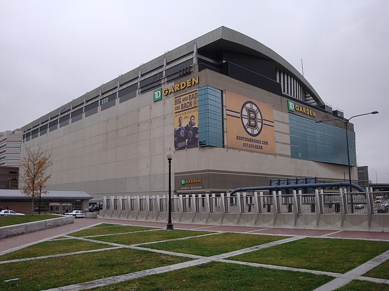
Photo: Nywalton, Public domain.
TD Garden is a multi-purpose arena in Boston. It is located directly above the MBTA's North Station, and it replaced the original Boston Garden upon opening in 1995. TD Garden is situated 3,500 feet southwest of Charlestown Navy Yard Ferry Terminal.
Places in the Area
Nearby places include North End and Charlestown.
North End

Photo: Rellimaz, CC BY-SA 3.0.
Known as "Little Italy" for over a hundred years, the North End proudly carries the torch of Boston's Italian heritage. Its narrow, dense streets consistently draw hordes of visitors looking to experience old world culture and first class dining.
Charlestown

Photo: Traveler100, CC BY-SA 3.0.
Boston's Charlestown was the traditional home of employees at the now-decommissioned Navy Yard. It has experienced a shift in its population and industry and an increasing number of young professionals are joining the families who have lived in the area for years.
East Boston

Photo: David Wilson, CC BY 2.0.
A lot of neighborhoods claim to be diverse, but East Boston is the real deal. "Eastie", as the locals call it, has always been a welcoming place for immigrants hoping to gain a toehold in Boston.
Charlestown Navy Yard Ferry Terminal
- Categories: passenger ship terminal and transportation
- Location: City of Boston, Suffolk, Massachusetts, New England, United States, North America
- View on OpenStreetMap
Latitude
42.37275° or 42° 22′ 22″ northLongitude
-71.05255° or 71° 3′ 9″ westOperator
MBTANetwork
MBTAOpen location code
87JC9WFW+3XOpenStreetMap ID
node 1146550134OpenStreetMap feature
amenity=ferry_terminalOpenStreetMap feature
public_transport=stationOpenStreetMap attribute
wheelchair=yes
This page is based on OpenStreetMap, Wikidata, and Wikimedia Commons.
We’d love your help improving our open data sources. Thank you for contributing.
Satellite Map
Discover Charlestown Navy Yard Ferry Terminal from above in high-definition satellite imagery.
Notable Places Nearby
Highlights include Water Shuttle Dock and Shipyard Park.
Nearby Places
Explore places such as Flagship Wharf and Courageous Sailing.
Massachusetts: Must-Visit Destinations
Delve into Boston, Cambridge, Springfield, and Downtown Boston.
Curious Stations to Discover
Uncover intriguing stations from every corner of the globe.
About Mapcarta. Data © OpenStreetMap contributors and available under the Open Database License". Text is available under the CC BY-SA 4.0 license, except for photos, directions, and the map. Photo: papadunes, CC BY-SA 3.0.