Csütörtökfalva
Csütörtökfalva is a locality in Miercurea Ciuc, Harghita. Csütörtökfalva is situated nearby to the quarter Cartierul Spicului, as well as near the suburb Centru.| Tap on a place to explore it |
Places of Interest
Highlights include Márton Áron National College and Kájoni János Library.
Márton Áron National College
School

Photo: Laslovarga, CC BY-SA 4.0.
Márton Áron National College is a high school located at 72 Márton Áron Street, Miercurea Ciuc, Romania.

Miercurea Ciuc Municipal Stadium
Sports venue

Photo: Rhinen, CC BY-SA 4.0.
The Miercurea Ciuc Municipal Stadium is a multi-use stadium in Miercurea Ciuc, Romania. It is used mostly for football matches and is the home ground of FK Miercurea Ciuc. The stadium holds 2,480 people.
Places in the Area
Nearby places include Cioboteni and Fitod.
Cioboteni
Suburb
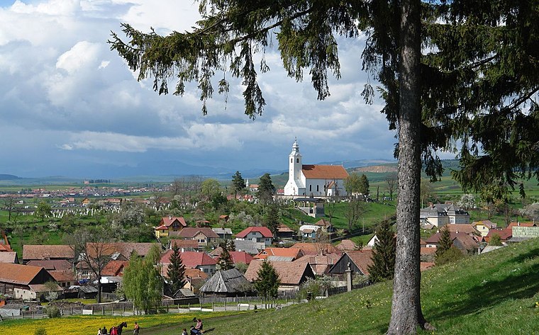
Photo: Thaler Tamas, CC BY-SA 3.0.
Cioboteni is a suburb, which is situated 3 km northeast of Csütörtökfalva.

Leliceni
Village
 Leliceni is a commune in Harghita County, Romania. It lies in the Székely Land, an ethno-cultural region in eastern Transylvania. Leliceni is situated 3½ km southeast of Csütörtökfalva.
Csütörtökfalva
- Type: Locality
- Location: Miercurea Ciuc, Harghita, Szeklerland, Transylvania, Romania, Balkans, Europe
- View on OpenStreetMap
Latitude
46.36663° or 46° 21′ 60″ northLongitude
25.80908° or 25° 48′ 33″ eastOpen location code
8GR79R85+JJOpenStreetMap ID
node 11476424333OpenStreetMap feature
place=locality
This page is based on OpenStreetMap, Wikidata, and Wikimedia Commons.
We’d love your help improving our open data sources. Thank you for contributing.
Satellite Map
Discover Csütörtökfalva from above in high-definition satellite imagery.
In Other Languages
“Csütörtökfalva” goes by many names.
- Hungarian: “Csütörtökfalva”
Localities in the Area
Explore places such as Cartierul Spicului and Centru.
Notable Places Nearby
Highlights include Piarista Tanulmányi Ház and Inspectoratul de Jandarmi Județean Harghita.
Harghita: Must-Visit Destinations
Delve into Băile Tuşnad, Borsec, Dârjiu, and Corund.
Curious Localities to Discover
Uncover intriguing localities from every corner of the globe.
About Mapcarta. Data © OpenStreetMap contributors and available under the Open Database License". Text is available under the CC BY-SA 4.0 license, except for photos, directions, and the map. Photo: Wikimedia, CC0.