Serres de Pauly
Serres de Pauly is a peak in Saint-Jean-de-Verges, Arrondissement of Foix, Occitanie and has an elevation of 470 metres. Serres de Pauly is situated nearby to the village Saint-Jean-de-Verges, as well as near the locality Ruines du Castella.| Tap on a place to explore it |
Places of Interest
Highlights include Château de Crampagna and Église Saint-Jean-Baptiste.

Église Saint-Jean-Baptiste
Church
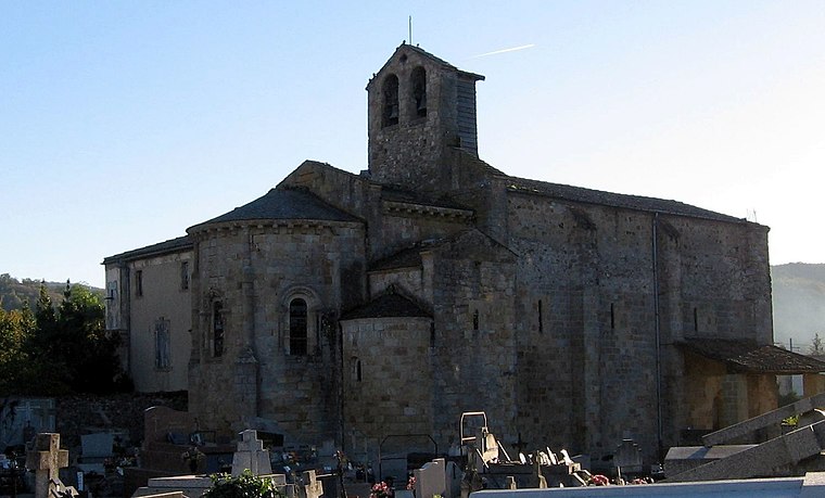
Photo: BastienM, CC BY-SA 3.0.
Église Saint-Jean-Baptiste is a church.
Chapelle Sainte-Germaine-de-Pibrac de Loubières
Church
 Chapelle Sainte-Germaine-de-Pibrac de Loubières is a church.
Places in the Area
Nearby places include Vernajoul and Foix.
Vernajoul
Village

Photo: HelenePETIT, CC BY-SA 3.0.
Vernajoul is a commune in the Ariège department in southwestern France.
Foix
Town

Photo: BastienM, CC BY-SA 3.0.
Foix is a medieval town at the foot of the Pyrenees in Ariège. It is surrounded by its castle which dominates the town. Perched on its rock, you cannot miss seeing it and, if you have a little time, visiting it.
Serres de Pauly
- Type: Peak with an elevation of 470 metres
- Category: landform
- Location: Saint-Jean-de-Verges, Arrondissement of Foix, Ariège, Occitanie, France, Europe
- View on OpenStreetMap
Latitude
43.0142° or 43° 0′ 51″ northLongitude
1.6281° or 1° 37′ 41″ eastElevation
470 metres (1,542 feet)Open location code
8FM32J7H+M6OpenStreetMap ID
node 11494093376OpenStreetMap feature
natural=peak
This page is based on OpenStreetMap, Wikidata, and Wikimedia Commons.
We’d love your help improving our open data sources. Thank you for contributing.
Satellite Map
Discover Serres de Pauly from above in high-definition satellite imagery.
Localities in the Area
Explore places such as Saint-Jean-de-Verges and Ruines du Castella.
Notable Places Nearby
Highlights include Ruines du Château de Marseillias and Roucairios.
Occitanie: Must-Visit Destinations
Delve into Haute-Garonne, Toulouse, Montpellier, and Aveyron.
Curious Peaks to Discover
Uncover intriguing peaks from every corner of the globe.
About Mapcarta. Data © OpenStreetMap contributors and available under the Open Database License". Text is available under the CC BY-SA 4.0 license, except for photos, directions, and the map. Photo: Pafmax, CC BY-SA 3.0.