Oikeusaputoimisto
Oikeusaputoimisto is a government office in Nurmes, Pielisen Karjala, North Karelia which is located on Torikatu. Oikeusaputoimisto is situated nearby to the government office Ulosottolaitos - Nurmeksen toimipiste, as well as near the police station Nurmeksen poliisiasema.| Tap on a place to explore it |
- Opening hours: Monday, Wednesday, and Friday 9:00 AM—11:00 AM and noon—3:00 PM
- Type: Government office
- Address: Torikatu 12, Nurmes, 75500
Places of Interest Nearby
Highlights include Nurmes railway station and Nurmes Church.
Nurmes railway station
Railway station
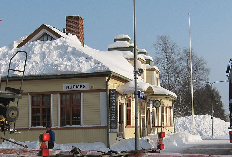
Photo: Wikimedia, CC BY-SA 3.0.
Nurmes railway station is situated 360 metres southwest of Oikeusaputoimisto.
Nurmes Church
Church
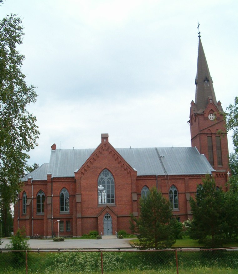
Photo: Pertsaboy, CC BY-SA 3.0.
Nurmes Church is situated 430 metres northwest of Oikeusaputoimisto.
Places in the Area
Nearby places include Porokylä.

Oikeusaputoimisto
- Categories: office and government building
- Location: Nurmes, Pielisen Karjala, North Karelia, Finnish Lakeland, Finland, Nordic countries, Europe
- View on OpenStreetMap
Latitude
63.54339° or 63° 32′ 36″ northLongitude
29.1432° or 29° 8′ 36″ eastOpen location code
9GMFG4VV+97OpenStreetMap ID
node 11556210439OpenStreetMap feature
office=government
This page is based on OpenStreetMap, Wikidata, and Wikimedia Commons.
We’d love your help improving our open data sources. Thank you for contributing.
Satellite Map
Discover Oikeusaputoimisto from above in high-definition satellite imagery.
Notable Places Nearby
Highlights include Ulosottolaitos - Nurmeksen toimipiste and Nurmeksen poliisiasema.
Nearby Places
Explore places such as Laulupuu (P.J. Hannikaisen muistomerkki) and Penan Pub.
North Karelia: Must-Visit Destinations
Delve into Joensuu, Kitee, Lieksa, and Outokumpu.
Curious Government Offices to Discover
Uncover intriguing government offices from every corner of the globe.
About Mapcarta. Data © OpenStreetMap contributors and available under the Open Database License". Text is available under the CC BY-SA 4.0 license, except for photos, directions, and the map. Photo: Wikimedia, CC0.