56th Street & 5th Avenue
56th Street & 5th Avenue is a tram stop in City of Kenosha, Kenosha County, Wisconsin. 56th Street & 5th Avenue is situated nearby to the health club Donna’s Gym-nastics, as well as near the restaurant Franks Diner.| Tap on a place to explore it |
Places of Interest Nearby
Highlights include Kenosha Public Museum and St. Matthew’s Episcopal Church.
Kenosha Public Museum
Museum
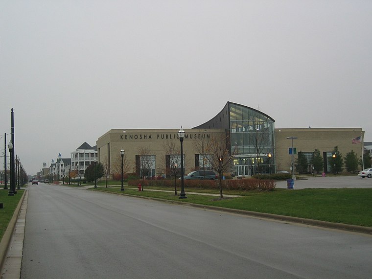
Photo: Kenokewl, CC BY-SA 3.0.
The Kenosha Public Museum, in Kenosha, Wisconsin, features displays of fine art, decorative art, and natural science specimens. Founded in 1933, and opened to the public in 1936 the museum currently is located at Kenosha's lakefront. Kenosha Public Museum is situated 1,300 feet east of 56th Street & 5th Avenue.
St. Matthew’s Episcopal Church
Church

Photo: Richie Diesterheft, CC BY 2.0.
St. Matthew's Episcopal Church is located in Kenosha, Wisconsin. It was added to the National Register of Historic Places for its architectural and religious significance in 1979. The church is a parish of the Episcopal Diocese of Milwaukee. St. Matthew’s Episcopal Church is situated 1,200 feet south of 56th Street & 5th Avenue.
Franks Diner
Restaurant
Franks Diner is a Jerry O'Mahony Diner Company lunch car diner in Kenosha, Wisconsin. Franks Diner is situated 570 feet south of 56th Street & 5th Avenue.
Places in the Area
Nearby places include Kenosha and Pleasant Prairie.
Kenosha

Photo: Keith Cooper, CC BY 2.0.
Kenosha is Wisconsin's fourth largest city. It is in the state's southeast region. Many of its residents commute to jobs elsewhere, leading to its appellation as "Chicago's northernmost suburb."…
Pleasant Prairie
Town
Pleasant Prairie is a village in Kenosha County, Wisconsin, United States. Located along the southwestern shoreline of Lake Michigan, Pleasant Prairie was home to 21,250 people at the 2020 census. Pleasant Prairie is situated 4½ miles southwest of 56th Street & 5th Avenue.
56th Street & 5th Avenue
- Type: Tram stop
- Categories: railway stop, transport stop, and transportation
- Location: City of Kenosha, Kenosha County, Southeast Wisconsin, Wisconsin, Midwest, United States, North America
- View on OpenStreetMap
Latitude
42.58512° or 42° 35′ 6″ northLongitude
-87.81751° or 87° 49′ 3″ westNetwork
Kenosha Area TransitOpen location code
86JJH5PJ+2XOpenStreetMap ID
node 1156132910OpenStreetMap feature
public_transport=stop_positionOpenStreetMap feature
railway=tram_stop
This page is based on OpenStreetMap, Wikidata, and Wikimedia Commons.
We’d love your help improving our open data sources. Thank you for contributing.
Satellite Map
Discover 56th Street & 5th Avenue from above in high-definition satellite imagery.
Notable Places Nearby
Highlights include Donna’s Gym-nastics and Friendship Park.
Nearby Places
Explore places such as Slip 56 and Wine Knot Bar& Bistro.
Southeast Wisconsin: Must-Visit Destinations
Delve into Milwaukee, Kenosha, Racine, and Waukesha.
Curious Tram Stops to Discover
Uncover intriguing tram stops from every corner of the globe.
About Mapcarta. Data © OpenStreetMap contributors and available under the Open Database License". Text is available under the CC BY-SA 4.0 license, except for photos, directions, and the map. Photo: Wikimedia, CC0.