Crimson Corner
Crimson Corner is a convenience store in Salt Lake, Utah. Crimson Corner is situated nearby to the residential area Fort Douglas, as well as near the historic building Officers Club.| Tap on a place to explore it |
Places of Interest Nearby
Highlights include Fort Douglas and Fort Douglas station.
Fort Douglas
Residential area

Photo: Milonica, CC BY-SA 3.0.
Fort Douglas was established in October 1862, during the American Civil War, as a small military garrison about three miles east of Salt Lake City, Utah. Fort Douglas is situated 390 feet southwest of Crimson Corner.
Fort Douglas station
Railway station
 Fort Douglas station is a light rail station named after the nearby Fort Douglas and on the campus of the University of Utah in Salt Lake City, Utah, in the United States, served by the Red Line of the Utah Transit Authority's TRAX light rail system. Fort Douglas station is situated 1,600 feet southwest of Crimson Corner.
University Hospital
Hospital

Photo: Klubbit, Public domain.
The University of Utah Hospital is a research and teaching hospital on the campus of the University of Utah in Salt Lake City, Utah. It serves as a major regional referral center for Utah and the surrounding states of Idaho, Nevada, Wyoming, Montana and Colorado. University Hospital is situated 2,400 feet northwest of Crimson Corner.
Places in the Area
Nearby places include Federal Heights and Yalecrest.
Federal Heights
Locality
Salt Lake City, often shortened to Salt Lake or SLC, is the capital and most populous city of the U.S. state of Utah. It is the county seat of Salt Lake County, the most populous county in the state.
Yalecrest
Neighborhood
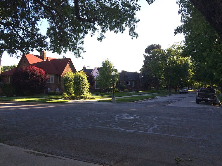
Photo: Kellymwhite, CC BY-SA 3.0.
Yalecrest is a residential neighborhood located on the East Bench of Salt Lake City. It runs south from Sunnyside Avenue to 1300 South and east from 1300 East to 1900 East. Yalecrest is situated 1½ miles southwest of Crimson Corner.
9th and 9th
Neighborhood
9th and 9th is a neighborhood in Salt Lake City, Utah located two blocks east of Liberty Park. The area gets its name from the intersection of 900 South and 900 East. 9th and 9th is situated 2 miles southwest of Crimson Corner.
Crimson Corner
- Opening hours: 24/7
- Type: Convenience store
- Categories: shop and food
- Location: Salt Lake, Utah, Southwest, United States, North America
- View on OpenStreetMap
Latitude
40.7662° or 40° 45′ 58″ northLongitude
-111.83141° or 111° 49′ 53″ westOperator
University of UtahOpen location code
85GCQ589+FCOpenStreetMap ID
node 11575607894OpenStreetMap feature
shop=convenience
This page is based on OpenStreetMap, Wikidata, and Wikimedia Commons.
We’d love your help improving our open data sources. Thank you for contributing.
Satellite Map
Discover Crimson Corner from above in high-definition satellite imagery.
Places with the Same Name
Discover other places named “Crimson Corner”.
Notable Places Nearby
Highlights include Officers Club and Lassonde House.
Nearby Places
Explore places such as Peterson Heritage Center and Benchmark Computer Lab.
Utah: Must-Visit Destinations
Delve into Salt Lake City, Provo, Bryce Canyon National Park, and West Valley City.
Curious Convenience Stores to Discover
Uncover intriguing convenience stores from every corner of the globe.
About Mapcarta. Data © OpenStreetMap contributors and available under the Open Database License". Text is available under the CC BY-SA 4.0 license, except for photos, directions, and the map. Photo: Chmehl, CC BY 2.5.