Wolf Village Building C
Wolf Village Building C is a bicycle parking in Raleigh, Wake, North Carolina. Wolf Village Building C is situated nearby to the pitch Wolf Vilage Volleyball Courts, as well as near the public building George Worsley Administrative Services Complex.| Tap on a place to explore it |
Places of Interest Nearby
Highlights include J. W. Isenhour Tennis Center and Doak Field.
J. W. Isenhour Tennis Center

Photo: Pithon314, CC BY-SA 4.0.
The J.W. Isenhour Tennis Center houses the men's and women's tennis programs of North Carolina State University in Raleigh, North Carolina. It is located across the street from Doak Field on the NC State campus. J. W. Isenhour Tennis Center is situated 1,300 feet east of Wolf Village Building C.
Doak Field
Pitch

Photo: Cgb628, CC BY-SA 3.0.
Doak Field is a baseball venue in Raleigh, North Carolina, United States. It opened in 1966 and is home to the NC State Wolfpack college baseball team of the NCAA's Division I Atlantic Coast Conference. Doak Field is situated 1,700 feet east of Wolf Village Building C.
James B. Hunt Jr. Library
Library

Photo: Seannator, CC BY-SA 3.0.
The James B. Hunt Jr. Library is the second main library of North Carolina State University and is located on the university's Centennial Campus. The $115 million facility opened in January 2013 and is best known for its architecture and technological… James B. Hunt Jr. Library is situated 1 mile east of Wolf Village Building C.
Places in the Area
Nearby places include Isabelle Bowen Henderson House and Gardens and Boylan Heights.
Isabelle Bowen Henderson House and Gardens
Neighborhood

Photo: Nyttend, Public domain.
Isabelle Bowen Henderson House and Gardens is a historic home and garden and national historic district located at Raleigh, North Carolina. The main house is a modest 19th century turreted late Victorian period frame cottage, with a Colonial Revival style studio wing and kitchen and dining porch added in 1937.
Boylan Heights
Neighborhood
Photo: Aigrette, CC BY-SA 3.0.
Boylan Heights is one of eight historic neighborhoods surrounding downtown Raleigh, North Carolina. Developed in the early 20th century it was one of the earliest planned suburbs in the city. Boylan Heights is situated 2 miles southeast of Wolf Village Building C.
Historic Oakwood
Neighborhood
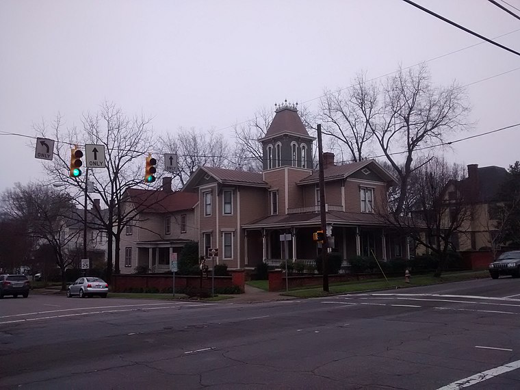
Photo: Mx. Granger, CC0.
Historic Oakwood is a neighborhood in downtown Raleigh, North Carolina, United States, on the National Register of Historic Places, and known for its Historic Oakwood Cemetery, its many Victorian houses and its location close to the Mordecai Plantation Manor. Historic Oakwood is situated 3 miles east of Wolf Village Building C.
Wolf Village Building C
- Type: Bicycle parking
- Category: transportation
- Location: Raleigh, Wake, North Carolina, South, United States, North America
- View on OpenStreetMap
Latitude
35.78668° or 35° 47′ 12″ northLongitude
-78.68542° or 78° 41′ 8″ westOpen location code
8773Q8P7+MROpenStreetMap ID
node 1157643614OpenStreetMap feature
amenity=bicycle_parking
This page is based on OpenStreetMap, Wikidata, and Wikimedia Commons.
We’d love your help improving our open data sources. Thank you for contributing.
Satellite Map
Discover Wolf Village Building C from above in high-definition satellite imagery.
Notable Places Nearby
Highlights include Wolf Vilage Volleyball Courts and George Worsley Administrative Services Complex.
Nearby Places
Explore places such as Wolf Village Bike Parking 2 and Caspian Hall.
North Carolina: Must-Visit Destinations
Delve into Charlotte, Asheville, Greensboro, and Durham.
Curious Bicycle Parkings to Discover
Uncover intriguing bicycle parkings from every corner of the globe.
About Mapcarta. Data © OpenStreetMap contributors and available under the Open Database License". Text is available under the CC BY-SA 4.0 license, except for photos, directions, and the map. Photo: Jmalljmall, Public domain.