Egerner Bucht
Egerner Bucht is a bay in Tegernsee, Miesbach, Bavaria.| Tap on a place to explore it |
Places of Interest
Highlights include Tegernsee Abbey and Baumgartenschneid.
Tegernsee Abbey
Castle

Photo: Wikimedia, CC BY-SA 3.0.
Tegernsee Abbey is a former Benedictine monastery in the town and district of Tegernsee in Bavaria. Both the abbey and the town that grew up around it are named after the Tegernsee, the lake on the shores of which they are located.
Baumgartenschneid
Peak

Photo: Luidger, CC BY-SA 3.0.
The Baumgartenschneid is a 1,448 metre high mountain in the Bavarian Prealps above the Tegernsee to the east.
Schloss Ringberg
Castle

Photo: Schtone, CC BY-SA 3.0.
Schloss Ringberg is located in the Bavarian Alps, 50 km south of Munich, on a foothill overlooking the Tegernsee. Not open to the general public, it is a property of the Max Planck Society and used for conferences.
Places in the Area
Nearby places include Schliersee and Rottach-Egern.
Schliersee

Photo: Tbp386, CC BY-SA 3.0.
Schliersee is a holiday and ski resort in Bavaria on the waterfront of the lake with the same name. It's on the edge of the Bavarian Alps, approximately 50 km south of Munich.
Rottach-Egern
Village

Photo: FotoweltMW, CC BY-SA 3.0.
Rottach-Egern is a municipality and town located at Lake Tegernsee in the district of Miesbach in Upper Bavaria, Germany, about 55 km south of central Munich. Late Austrian actor Walter Slezak is buried in this area.
Bad Wiessee
Village
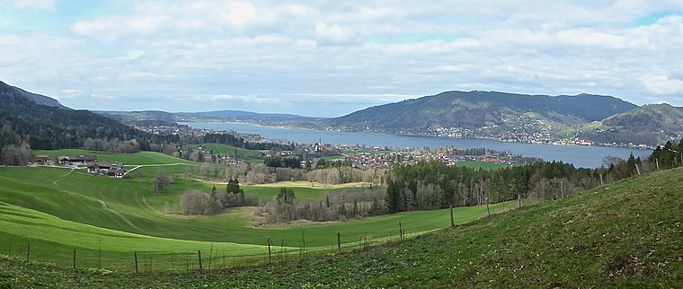
Photo: Ventus55, CC BY-SA 4.0.
Bad Wiessee is a municipality in the district of Miesbach in Upper Bavaria in Germany. Since 1922, it has been a spa town and located on the western shore of the Tegernsee Lake.
Egerner Bucht
- Type: Bay
- Category: body of water
- Location: Tegernsee, Miesbach, Upper Bavaria, Bavaria, Germany, Central Europe, Europe
- View on OpenStreetMap
Latitude
47.6982° or 47° 41′ 54″ northLongitude
11.7648° or 11° 45′ 53″ eastOpen location code
8FVHMQX7+7WOpenStreetMap ID
node 11612746654OpenStreetMap feature
natural=bay
This page is based on OpenStreetMap, Wikidata, and Wikimedia Commons.
We’d love your help improving our open data sources. Thank you for contributing.
Satellite Map
Discover Egerner Bucht from above in high-definition satellite imagery.
Localities in the Area
Explore places such as Leeberg and Egern.
Notable Places Nearby
Highlights include Peter Prechtl Antiquitäten and Bücherei Rottach-Egern.
Upper Bavaria: Must-Visit Destinations
Delve into Munich, Ingolstadt, Dachau, and Rosenheim.
Curious Bays to Discover
Uncover intriguing bays from every corner of the globe.
About Mapcarta. Data © OpenStreetMap contributors and available under the Open Database License". Text is available under the CC BY-SA 4.0 license, except for photos, directions, and the map. Photo: FotoweltMW, CC BY-SA 3.0.