City Sightseeing #4
City Sightseeing #4 is a bus stop in City of Cape Town, Western Cape. City Sightseeing #4 is situated nearby to the convention center Cape Town International Convention Centre, as well as near Convention Square.| Tap on a place to explore it |
Places of Interest Nearby
Highlights include Cape Town International Convention Centre and Cape Town Stadium.
Cape Town International Convention Centre
Convention center
The Cape Town International Convention Centre is a large convention center in Cape Town, South Africa. The centre opened in June 2003. It is run as a partnership between the City of Cape Town and the Western Cape government. Cape Town International Convention Centre is situated 110 metres east of City Sightseeing #4.
Cape Town Stadium
Stadium
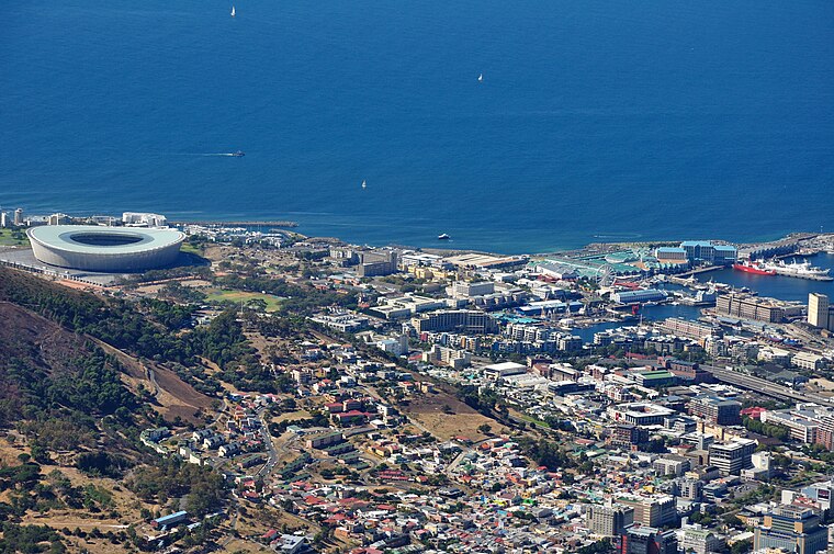
Photo: Simisa, CC BY-SA 3.0.
The Cape Town Stadium is an association football and rugby union stadium in Cape Town, South Africa, that was built as part of the country's hosting of the 2010 FIFA World Cup. Cape Town Stadium is situated 2 km northwest of City Sightseeing #4.
Southern Sun The Cullinan
Hotel

Photo: Mike Peel, CC BY-SA 4.0.
Southern Sun The Cullinan is a hotel, which is situated 140 metres northwest of City Sightseeing #4.
Places in the Area
Nearby places include Cape Town and V&A Waterfront.
Cape Town
 Cape Town is the second most populous city in South Africa. The capital of Western Cape Province, it is also the legislative capital of the nation. Cape Town is on South Africa's southwestern coast close to the Cape of Good Hope, and is the southernmost city on the African continent.
V&A Waterfront
Suburb

Photo: Damien du Toit, CC BY 2.0.
The V&A Waterfront, often referred to as The Waterfront and The V&A, is a mixed-use suburb in Cape Town, South Africa, featuring upmarket residential apartments, a major shopping mall, a marina, and multiple large hotels.
Schotsche Kloof
Suburb
The Bo-Kaap is an area of Cape Town, South Africa formerly known as the Malay Quarter. It is a former racially segregated area, situated on the slopes of Signal Hill above the city centre and is a historical centre of Cape Malay culture in Cape Town.
City Sightseeing #4
- Type: Bus stop
- Category: transportation
- Location: City of Cape Town, Western Cape, South Africa, Southern Africa, Africa
- View on OpenStreetMap
Latitude
-33.91628° or 33° 54′ 59″ southLongitude
18.42594° or 18° 25′ 33″ eastOpen location code
4FRW3CMG+F9OpenStreetMap ID
node 11626236471OpenStreetMap feature
highway=bus_stop
This page is based on OpenStreetMap, Wikidata, and Wikimedia Commons.
We’d love your help improving our open data sources. Thank you for contributing.
Satellite Map
Discover City Sightseeing #4 from above in high-definition satellite imagery.
Notable Places Nearby
Highlights include Convention Square and Pier Place.
Nearby Places
Explore places such as Telkom and Convention Centre.
Western Cape: Must-Visit Destinations
Delve into Cape Town, Robben Island, Stellenbosch, and George.
Curious Bus Stops to Discover
Uncover intriguing bus stops from every corner of the globe.
About Mapcarta. Data © OpenStreetMap contributors and available under the Open Database License". Text is available under the CC BY-SA 4.0 license, except for photos, directions, and the map. Photo: Wikimedia, CC BY-SA 3.0.