Auwiesenhütte
Auwiesenhütte is in Gernsbach, Rastatt, Baden-Württemberg. Auwiesenhütte is situated nearby to the pitch Gleitschirm-Landeplatz Nordost, as well as near the playground Treffpunkt-Spielplatz.| Tap on a place to explore it |
Places of Interest Nearby
Highlights include Pauluskirche and Merkur.
Pauluskirche
Church

Photo: Gerd Eichmann, CC BY-SA 4.0.
Pauluskirche is a church, which is situated 1 km southeast of Auwiesenhütte.
Merkur
Scenic viewpoint

Photo: Sitacuisses, CC BY-SA 3.0.
The Merkur or Großer Staufenberg is a mountain, 668.3 m above sea level, in the Northern Black Forest, Baden-Württemberg, Germany. It is the Hausberg of Baden-Baden and located between the spa town and the town of Gernsbach. Merkur is situated 1½ km southwest of Auwiesenhütte.
St. Nikolaus
Church

Photo: Gerd Eichmann, CC BY-SA 4.0.
St. Nikolaus is a church, which is situated 1½ km northeast of Auwiesenhütte.
Places in the Area
Nearby places include Ottenau and Gaggenau.
Ottenau
Suburb

Photo: Gerd Eichmann, CC BY-SA 4.0.
Ottenau is a suburb, which is situated 3½ km northeast of Auwiesenhütte.
Gaggenau
Town

Photo: Wikimedia, CC BY-SA 3.0.
Gaggenau is a town in the district of Rastatt, in Baden-Württemberg, Germany. It is located some 8 km northeast of Baden-Baden. Gaggenau is situated 4 km northeast of Auwiesenhütte.
Baden-Baden
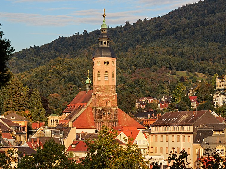
Photo: A.Savin, CC BY-SA 3.0.
Baden-Baden is a spa town built on thermal springs at the edge of the Black Forest in Baden Württemberg, south west Germany. It is one of 11 "Great Spa Towns of Europe", a transcontinental UNESCO world heritage site.
Auwiesenhütte
- Type: Sign
- Also known as: “Sportplatz Staufenberg”
- Categories: information and tourism
- Location: Gernsbach, Rastatt, Karlsruhe Region, Baden-Württemberg, Germany, Central Europe, Europe
- View on OpenStreetMap
Latitude
48.77044° or 48° 46′ 14″ northLongitude
8.29706° or 8° 17′ 49″ eastElevation
319 metres (1,047 feet)Operator
SchwarzwaldvereinOpen location code
8FWCQ7CW+5ROpenStreetMap ID
node 11642362495OpenStreetMap feature
tourism=information
This page is based on OpenStreetMap, Wikidata, and Wikimedia Commons.
We’d love your help improving our open data sources. Thank you for contributing.
Satellite Map
Discover Auwiesenhütte from above in high-definition satellite imagery.
Places with the Same Name
Discover other places named “Auwiesenhütte”.
Notable Places Nearby
Highlights include Sportplatz Staufenberg and Gleitschirm-Landeplatz Nordost.
Nearby Places
Explore places such as Auwiesenhütte and Auweg.
Baden-Württemberg: Must-Visit Destinations
Delve into Stuttgart, Heidelberg, Karlsruhe, and Mannheim.
Curious Places to Discover
Uncover intriguing places from every corner of the globe.
About Mapcarta. Data © OpenStreetMap contributors and available under the Open Database License". Text is available under the CC BY-SA 4.0 license, except for photos, directions, and the map. Photo: Traveler100, CC BY-SA 3.0.