Gesundheitszentrum Rosental
Gesundheitszentrum Rosental is a clinic in Rosental an der Kainach, Voitsberg District, Styria which is located on Hauptstraße. Gesundheitszentrum Rosental is situated nearby to the town hall Gemeindeamt Rosental a.d.K., as well as near the church Gradner Kapelle.| Tap on a place to explore it |
Places of Interest Nearby
Highlights include St. Barbarakirche and Heiliger Berg Karmel, Bärnbach.
St. Barbarakirche
Church
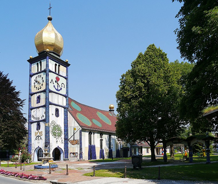
Photo: Zairon, CC BY-SA 3.0.
St. Barbarakirche is a church, which is situated 2 km northeast of Gesundheitszentrum Rosental.
Heiliger Berg Karmel, Bärnbach
Building

Photo: Steinbergjohann, CC BY-SA 3.0 at.
Heiliger Berg Karmel, Bärnbach is a building, which is situated 1¼ km northeast of Gesundheitszentrum Rosental.
Oberjäger-Kapelle, Bärnbach
Wayside shrine

Photo: Steinbergjohann, CC BY-SA 3.0 at.
Oberjäger-Kapelle, Bärnbach is a wayside shrine, which is situated 2 km east of Gesundheitszentrum Rosental.
Places in the Area
Nearby places include Piberegg and Gößnitz.
Piberegg
Village
Piberegg is a former municipality in the district of Voitsberg in the Austrian state of Styria. Since the 2015 Styria municipal structural reform, it is part of the municipality Bärnbach. Piberegg is situated 4½ km north of Gesundheitszentrum Rosental.
Gößnitz
Village

Photo: Liuthalas, CC BY-SA 4.0.
Gößnitz is a former municipality in the district of Voitsberg in the Austrian state of Styria. Since the 2015 Styria municipal structural reform, it is part of the municipality Maria Lankowitz. Gößnitz is situated 7 km west of Gesundheitszentrum Rosental.
Södingberg
Village
Södingberg is a former municipality in the district of Voitsberg in the Austrian state of Styria. Since the 2015 Styria municipal structural reform, it is part of the municipality Geistthal-Södingberg. Södingberg is situated 7 km northeast of Gesundheitszentrum Rosental.
Gesundheitszentrum Rosental
- Type: Clinic
- Address: Hauptstraße 85, Rosental an der Kainach, 8582
- Category: health care
- Location: Rosental an der Kainach, Voitsberg District, Styria, Austria, Central Europe, Europe
- View on OpenStreetMap
Latitude
47.05516° or 47° 3′ 19″ northLongitude
15.1143° or 15° 6′ 52″ eastOperator
Joachim JaukOpen location code
8FVQ3447+3POpenStreetMap ID
node 11740752616OpenStreetMap feature
amenity=clinicOpenStreetMap feature
healthcare=clinic
This page is based on OpenStreetMap, Wikidata, and Wikimedia Commons.
We’d love your help improving our open data sources. Thank you for contributing.
Satellite Map
Discover Gesundheitszentrum Rosental from above in high-definition satellite imagery.
Notable Places Nearby
Highlights include Gemeindeamt Rosental a.d.K. and Gradner Kapelle.
Nearby Places
Explore places such as Heissenberger Modeland and Sparkasse.
Styria: Must-Visit Destinations
Delve into Graz, Leoben, Bruck an der Mur, and Kapfenberg.
Curious Clinics to Discover
Uncover intriguing clinics from every corner of the globe.
About Mapcarta. Data © OpenStreetMap contributors and available under the Open Database License". Text is available under the CC BY-SA 4.0 license, except for photos, directions, and the map. Photo: Kmarka, CC BY-SA 3.0.