El Mocanal
El Mocanal is a hamlet in Las Palmas, Gran Canaria and has about 180 residents. El Mocanal is situated nearby to the suburb Monte Lentiscal, as well as near the hamlet Cuesta el Reventón.| Tap on a place to explore it |
Places of Interest
Highlights include Bandama Caldera and Jardín Botánico Canario Viera y Clavijo.
Bandama Caldera
Volcano
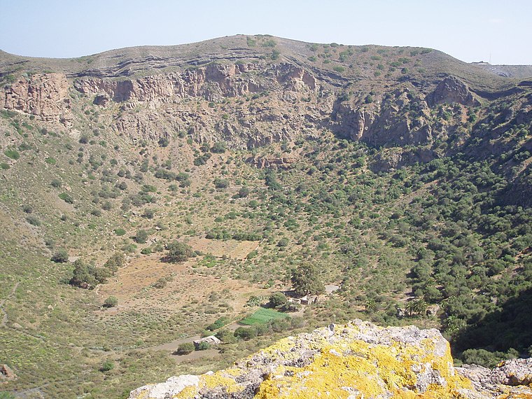
Photo: W. Edlmeier, CC BY 1.0.
The Bandama Natural Monument is part of the Tafira Protected Landscape on the island of Gran Canaria in the Canary Islands, Spain. It is considered a point of geological interest, because of the Caldera de Bandama.
Jardín Botánico Canario Viera y Clavijo
Museum
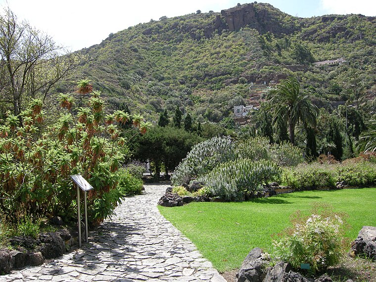
Photo: Sailko, CC BY-SA 3.0.
Jardín Botánico Canario Viera y Clavijo is the full name of the botanical garden on Gran Canaria, one of the Canary Islands. "Jardín Botánico Canario" means "Botanical Garden of the Canaries", while the additional words "Viera y Clavijo" honor the pioneering… Jardín Botánico Canario Viera y Clavijo is situated 2½ km north of El Mocanal.
Ermita de la Concepción
Church
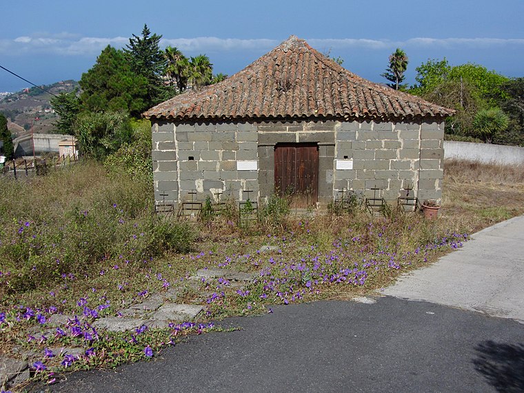
Photo: Rvr, CC BY-SA 4.0.
Ermita de la Concepción is a church, which is situated 2½ km southwest of El Mocanal.
Places in the Area
Nearby places include Eastern Gran Canaria and Lomo Magullo.
Eastern Gran Canaria
The eastern part of Gran Canaria is the economically most important part of the island. Traces of the "old Canaries" can be found here, where the oldest settlements of the Spaniards were.Lomo Magullo
Suburb

Photo: DanielRiveroSuárez, CC BY-SA 3.0.
Lomo Magullo is a suburb, which is situated 7 km south of El Mocanal.
Siete Palmas
Suburb

Photo: Beta15, CC BY-SA 4.0.
Siete Palmas is a suburb, which is situated 7 km north of El Mocanal.
El Mocanal
- Type: Hamlet with 180 residents
- Category: locality
- Location: Las Palmas, Las Palmas, Gran Canaria, Canary Islands, Spain, Iberia, Europe
- View on OpenStreetMap
Latitude
28.04211° or 28° 2′ 32″ northLongitude
-15.47034° or 15° 28′ 13″ westPopulation
180Elevation
410 metres (1,345 feet)Open location code
7CW62GRH+RVOpenStreetMap ID
node 11757807753OpenStreetMap feature
place=hamlet
This page is based on OpenStreetMap, Wikidata, and Wikimedia Commons.
We’d love your help improving our open data sources. Thank you for contributing.
Satellite Map
Discover El Mocanal from above in high-definition satellite imagery.
Places with the Same Name
Discover other places named “El Mocanal”.
Localities in the Area
Explore places such as Monte Lentiscal and Cuesta el Reventón.
Notable Places Nearby
Highlights include Club de Tenis Tafira and Hotel Escuela Santa Brígida.
Gran Canaria: Must-Visit Destinations
Delve into Telde, Ingenio, Maspalomas, and Playa del Inglés.
Curious Hamlets to Discover
Uncover intriguing hamlets from every corner of the globe.
About Mapcarta. Data © OpenStreetMap contributors and available under the Open Database License". Text is available under the CC BY-SA 4.0 license, except for photos, directions, and the map. Photo: Gino maccanti, CC BY 2.0.