VAG_Rad-Station Waldfriedhof
VAG_Rad-Station Waldfriedhof is a bike rental in Schwabach, Middle Franconia, Bavaria. VAG_Rad-Station Waldfriedhof is situated nearby to the peak Sandbuck, as well as near the railway stop Schwabach-Limbach.| Tap on a place to explore it |
Places of Interest Nearby
Highlights include Schwabach and St. Johannes and St. Martin.
Schwabach
Railway station
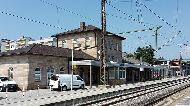
Photo: Dealerofsalvation, CC BY-SA 4.0.
Schwabach station is a railway station in the municipality of Schwabach, located in Middle Franconia, Germany. The station is on the Nuremberg–Augsburg and Nuremberg–Roth lines of Deutsche Bahn. Schwabach is situated 1¼ km south of VAG_Rad-Station Waldfriedhof.
St. Johannes and St. Martin
Church
 St. Johannes and St. Martin is a church, which is situated 1¼ km southwest of VAG_Rad-Station Waldfriedhof.
St. Sebald
Church

Photo: Helmlechner, CC BY-SA 3.0.
St. Sebald is a church, which is situated 1 km southwest of VAG_Rad-Station Waldfriedhof.
Places in the Area
Nearby places include Nasbach and Katzwang.

Katzwang
Suburb

Photo: Jailbird, CC BY-SA 2.0 de.
Katzwang, formerly a separate municipality, has been a part of Nuremberg in Bavaria, Germany, since 1 July 1972. It is located on a ford across the Rednitz river, in the south of the city.
Schwarzach bei Schwabach
Hamlet

Photo: Siegmar S., CC BY-SA 3.0.
Schwarzach bei Schwabach is a hamlet, which is situated 2½ km east of VAG_Rad-Station Waldfriedhof.
VAG_Rad-Station Waldfriedhof
- Type: Bike rental
- Category: transportation
- Location: Schwabach, Middle Franconia, Franconia, Bavaria, Germany, Central Europe, Europe
- View on OpenStreetMap
Latitude
49.33678° or 49° 20′ 12″ northLongitude
11.03515° or 11° 2′ 7″ eastNetwork
VAG_RadOpen location code
8FXH82PP+P3OpenStreetMap ID
node 11807384689OpenStreetMap feature
amenity=bicycle_rental
This page is based on OpenStreetMap, Wikidata, and Wikimedia Commons.
We’d love your help improving our open data sources. Thank you for contributing.
Satellite Map
Discover VAG_Rad-Station Waldfriedhof from above in high-definition satellite imagery.
Notable Places Nearby
Highlights include Sandbuck and Waldfriedhof.
Nearby Places
Explore places such as Hardenbergstr. and Blumen Jungegger.
Middle Franconia: Must-Visit Destinations
Delve into Nuremberg, Erlangen, Fürth, and Ansbach.
Curious Bike Rentals to Discover
Uncover intriguing bike rentals from every corner of the globe.
About Mapcarta. Data © OpenStreetMap contributors and available under the Open Database License". Text is available under the CC BY-SA 4.0 license, except for photos, directions, and the map. Photo: Traveler100, CC BY-SA 4.0.